Deep Depression Over Bay of Bengal Threatens South Bengal Rainfall
Source:The Hindu ↗
Why It Matters
Weather patterns, specifically deep depressions and monsoons originating from the Bay of Bengal, are crucial for West Bengal's climate, agriculture, and water resources. Frequent cyclonic disturbances necessitate effective early warning and disaster management systems by institutions like the IMD.
Summary
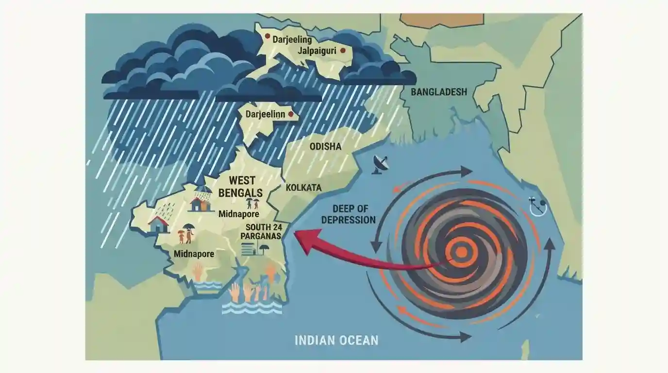
The Indian Meteorological Department (IMD) has forecast heavy to very heavy rainfall across south Bengal districts and sub-Himalayan regions due to a deep depression over the Bay of Bengal, which is moving towards the West Bengal-Odisha coasts.
Key Points
- A deep depression over the Bay of Bengal is bringing heavy to very heavy rainfall to South Bengal districts until July 28.
- The weather system is moving north-westward and is expected to cross the West Bengal-Odisha coasts.
- Coastal and adjoining districts like Paschim Medinipur, Jhargram, South 24 Parganas, and Purba Medinipur will face the brunt of the heavy downpour.
- Sub-Himalayan districts in North Bengal, including Darjeeling and Kalimpong, are also expected to experience isolated heavy precipitation.
- The IMD has issued advisories for fishermen against venturing into the sea due to squally winds of up to 75 kmph.
Important Terms
India Meteorological Department (IMD)

The principal agency of the Ministry of Earth Sciences responsible for meteorological observations and weather forecasting. It serves as the regional nodal center for predicting and issuing warnings for tropical cyclones in the Northern Indian Ocean.
UPSC context
GS Papers 1 and 3. Tests knowledge of disaster early warning systems, climate monitoring, and the Ministry of Earth Sciences.
Deep Depression
A stage in the formation of a tropical cyclone characterized by a low-pressure system with maximum sustained wind speeds between 50 and 61 km/h, indicating intensification before reaching full cyclonic storm status.
UPSC context
GS Paper 1 (Climatology). Tests understanding of tropical cyclone genesis, IMD's wind speed classification, and extreme weather phenomena.
Bay of Bengal
A basin-shaped region in the northeastern Indian Ocean that experiences high cyclonic activity due to high sea surface temperatures, low salinity from river discharge, and a funnel-like geography amplifying storm surges.
UPSC context
GS Paper 1 (Physical Geography). Tests comparative oceanography, cyclone formation factors, and vulnerabilities of the eastern Indian coastline.
Sub-Himalayan West Bengal
A specific physiographic and IMD meteorological subdivision in northern West Bengal. It features varied topography from mountains to plains and is highly prone to extreme monsoonal rainfall and river flooding.
UPSC context
GS Paper 1 (Indian Geography). Tests knowledge of India's regional climatic zones, monsoonal impacts, and specific physiographic divisions.
Prelims Trap
"Deep Depressions are characterized by wind speeds exceeding 62 km/h and form predominantly in the Arabian Sea during the monsoon."
Wind speeds of 62+ km/h classify as a Cyclonic Storm, not a Deep Depression (50-61 km/h). Furthermore, monsoon depressions predominantly form in the Bay of Bengal, not the Arabian Sea.
Static Concepts Connected
How does IMD classify cyclonic disturbances by wind speed?
- Depression: Wind speeds between 31 and 49 km/h (17-27 knots).
- Deep Depression: Maximum sustained surface wind speeds of 50 to 61 km/h (28-33 knots).
- Cyclonic Storm: Wind speeds of 62 to 88 km/h (34-47 knots), at which point the system is officially assigned a name.
Why are full-blown severe cyclones rare during the peak SW Monsoon?
- High Vertical Shear: Strong vertical wind shear during July-August disrupts the organized vertical structure required for cyclonic storm intensification.
- Proximity to Coast: Low-pressure systems often form at the head of the Bay of Bengal, giving them short sea-travel time before making landfall.
Cross-Topic Patterns
Monsoon Depressions & Kharif Sowing
Heavy mid-monsoon rains in West Bengal and Odisha directly influence paddy cultivation, linking GS1 climatology events with GS3 agricultural cropping patterns and food security.
Early Warning & Coastal Disaster Prep
IMD's color-coded weather alerts and precise rainfall terminology (heavy vs. extremely heavy) form the mandatory baseline for the NDRF's coastal evacuation protocols and NIDM's planning.

Expect a Prelims matching-pair question pairing IMD cyclonic classifications (Depression vs Storm) with their specific wind speed ranges.
Linked PYQs · 3
Linked PYQs · 3
- 2013WBCS_PRELIMSGS1
Cyclones of the Bay of Bengal are common during the
- 2015WBCS_PRELIMSGS1
West Bengal gets most of its rainfall from
- 2011WBCS_PRELIMSGS1
Rainfall in West Bengal occurs due to summer monsoon by
