Kakinada Coast Rehabilitation Centres for Cyclone Montha
Source:The Hindu ↗
Why It Matters
The article provides a practical case study of disaster preparedness and mitigation strategies in India. It illustrates the critical role of early warning systems (IMD), deployment of response forces (NDRF/SDRF), and socio-economic protection (advisories for farmers and coastal fisherfolk), directly aligning with the GS3 syllabus on disaster management.
Summary
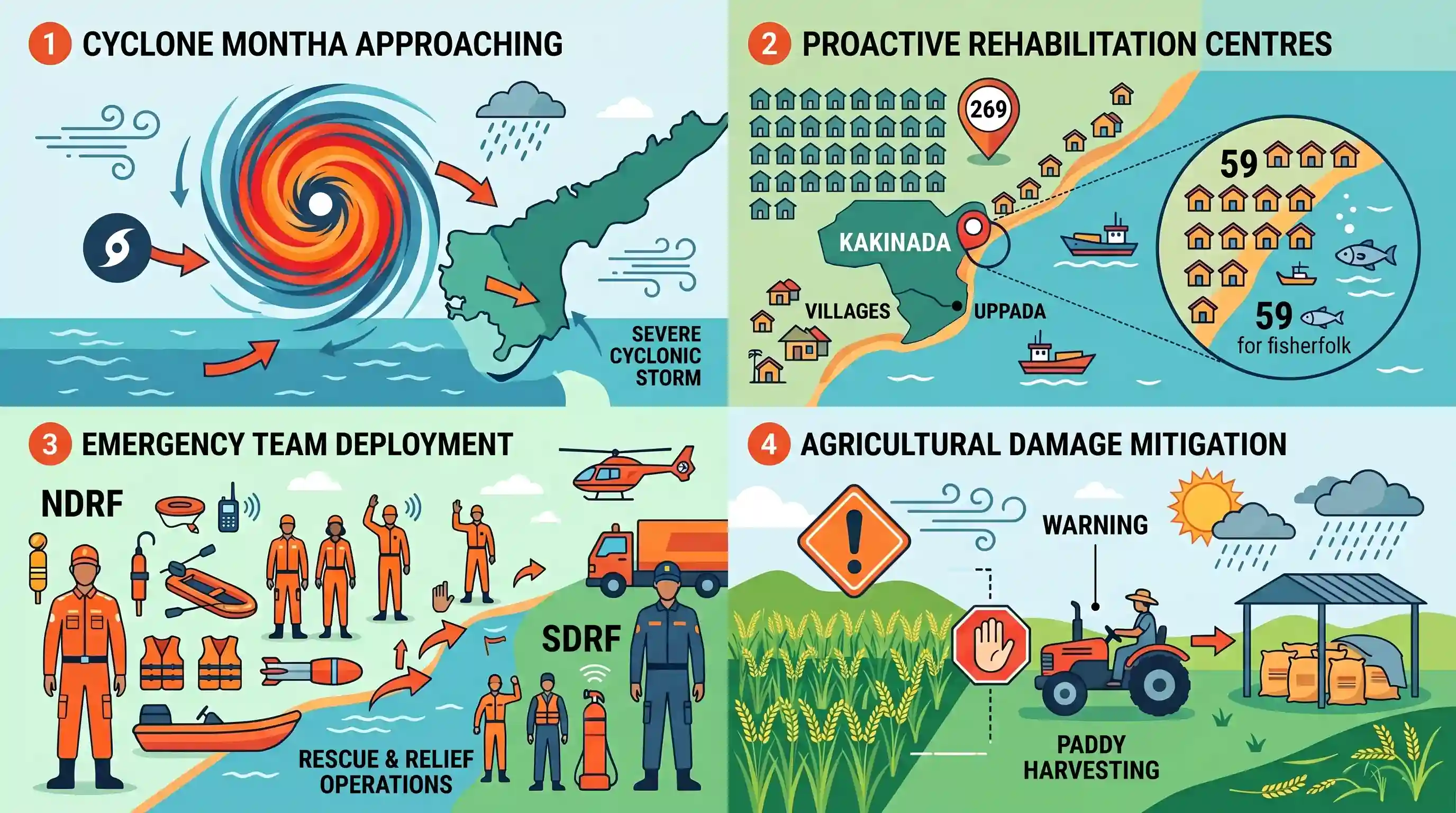
In anticipation of Cyclone Montha making landfall along the Kakinada coast as a severe cyclonic storm, the Andhra Pradesh district administration has proactively opened 269 rehabilitation centres. Special focus is on the vulnerable Uppada coast, where 59 centres cater to local fisherfolk. Teams from the NDRF and SDRF have been strategically deployed for immediate rescue and relief operations. Additionally, local farmers have been warned to halt paddy harvesting to minimize crop damage from the severe weather system.
Key Points
- Cyclone Montha is projected by the IMD to make landfall as a severe cyclonic storm along the Kakinada coast.
- The district administration has opened 269 rehabilitation centres, including 59 along the Uppada coast specifically targeted to protect vulnerable fisherfolk.
- Emergency response teams comprising 30 NDRF personnel and 50 SDRF personnel have been deployed for rescue and relief operations.
- Farmers in the Dr. B.R. Ambedkar Konaseema district have been advised to halt paddy harvesting to mitigate agricultural losses from expected heavy rainfall and winds.
Important Terms
India Meteorological Department (IMD)

India's principal government agency for meteorology, seismology, and weather forecasting, established in 1875 under the Ministry of Earth Sciences to provide early warnings for weather-sensitive activities.
UPSC context
GS Paper I (Geography) and Paper III (Disaster Management); tests institutional frameworks for early warning and climate monitoring.
National Disaster Response Force (NDRF)
A specialized paramilitary force established under the Disaster Management Act, 2005, responsible for multi-hazard response to natural and man-made disasters across India.
UPSC context
GS Paper III (Disaster Management); essential for understanding federal disaster response architecture and search-and-rescue mandates.
State Disaster Response Force (SDRF)
A state-level specialized unit, modeled after the NDRF, responsible for immediate search-and-rescue operations during regional disasters as part of the three-tier disaster management structure.
UPSC context
GS Paper III (Disaster Management); tests knowledge of state-level preparedness and Centre-State coordination in crisis handling.
Severe Cyclonic Storm (SCS)
An IMD classification for tropical cyclones having maximum sustained surface wind speeds between 48–63 knots (approximately 89–117 kmph), indicating high destructive potential.
UPSC context
GS Paper I (Geography); tests technical understanding of cyclone intensity and classification criteria.
Landfall
The event where the eye or center of a tropical cyclone moves from water to land, often marked by the highest storm surges and peak wind speeds.
UPSC context
GS Paper I (Geography); critical for predicting disaster impact zones and planning evacuation timelines.
Coastal Vulnerability
The susceptibility of coastal areas to hazards like cyclones and storm surges, influenced by physical factors and the socio-economic resilience of local communities.
UPSC context
GS Paper III (Environment/Disaster Management); focuses on climate adaptation and mitigation strategies for high-risk coastal populations.
Prelims Trap
"Tropical cyclones intensify after making landfall due to increased surface friction."
Cyclones dissipate quickly after making landfall because their primary energy source—the continuous supply of moisture and latent heat from warm oceans—is cut off.
Static Concepts Connected
What are the key atmospheric conditions required for the formation of tropical cyclones?
- Warm Sea Surface: Temperatures above 26.5°C provide the continuous supply of moisture and latent heat necessary for storm development.
- Coriolis Force: Sufficient Coriolis force is needed to create a cyclonic vortex, which explains why cyclones do not form directly at the equator.
- Low Wind Shear: Low vertical wind shear allows the storm structure to remain intact vertically without being torn apart by upper-level winds.
What is the institutional structure for disaster response under the Disaster Management Act, 2005?
- NDMA: The apex statutory body headed by the Prime Minister, responsible for laying down national disaster management policies and guidelines.
- NDRF: A specialized statutory force deployed for threatening disaster situations, operating under the general superintendence of the NDMA.
- State Executive Committee: Headed by the Chief Secretary of the state, it coordinates and monitors state-level disaster response and relief operations.
Cross-Topic Patterns
Coastal Erosion & Climate Vulnerability
The focus on the Uppada coast highlights how rising sea levels and intense cyclones exacerbate structural coastal erosion, bridging physical geography and climate vulnerability.
Early Warning Systems & Agriculture
Advisories to halt paddy harvesting show how IMD's meteorological forecasting directly integrates with agricultural resilience, mitigating crop shocks and protecting farmer livelihoods.

Changing Bay of Bengal cyclone intensity, coastal erosion, and early warning efficacy are highly probable for a 2026 Mains GS-3 question.
Linked PYQs · 4
Linked PYQs · 4
- 2024MainsGS1
What is sea surface temperature rise? How does it affect the formation of tropical cyclones?
- 2014MainsGS1
Tropical cyclones are largely confined to South China Sea, Bay of Bengal and Gulf of Mexico. Why?
- 2019MainsGS3
Disaster preparedness is the first step in any disaster management process. Explain how hazard zonation mapping will help disaster mitigation in the case of landslides.
- 2024MainsGS3
What is disaster resilience? How is it determined? Describe various elements of a resilience framework. Also mention the global targets of Sendai Framework for Disaster Risk Reduction (2015–2030).
