Urban Heat Island Effect and Limitations of Climate Models
Source:The Hindu ↗
Why It Matters
Understanding the true extent of urban heating is critical for UPSC aspirants studying geography and environment, as it directly impacts urban planning, disaster management (heatwaves), and climate resilience strategies in India.
Summary
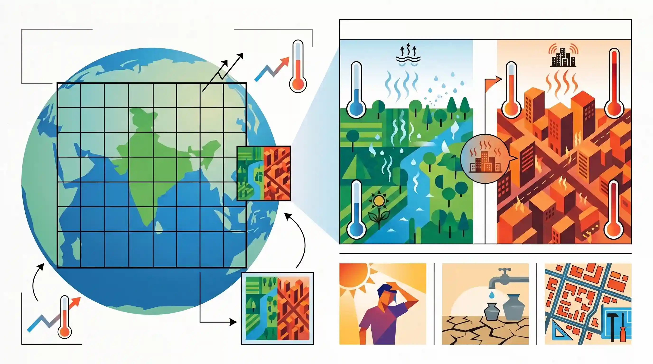
A recent study by the University of East Anglia reveals that global climate models significantly underestimate how much hotter Indian cities will become compared to their rural surroundings. Because standard models operate at coarse resolutions, they mask the 'Urban Heat Island' effect—specifically, the cooling benefit of evapotranspiration found in vegetated rural areas that is absent in impervious urban landscapes. Consequently, while general models predict a 2°C regional rise, actual urban warming could be between 2.6°C and 4°C in places like Patiala. This hidden heat stress poses major challenges for public health, water availability, and urban planning in India.
Key Points
- Current global climate models operate at coarse resolutions that blend urban and rural landscapes, failing to accurately capture city-specific temperature rises.
- A study of 18 Indian cities by the University of East Anglia found they experience about 45% more warming than Earth System Models (ESMs) project for the broader region.
- In extreme outliers like Patiala, Punjab, temperatures could rise at double the rate of the surrounding rural area, reaching a 4°C rise instead of the projected 2°C.
- The primary driver for the urban-rural temperature gap is vegetation-driven cooling (evapotranspiration) in rural areas, which cities lack due to impervious surfaces.
- Underestimating urban temperature rise has severe implications for public health, increasing the risk of heat strokes, water scarcity, and public expenditure on cooling.
Important Terms
Urban Heat Island (UHI)

A phenomenon where urban areas experience significantly higher temperatures than surrounding rural areas due to concrete density, lack of vegetation, and human activities trapping heat.
UPSC context
GS Paper I (Geography) and GS Paper III (Environment); focuses on urban planning, climate change, and public health.
Evapotranspiration
The combined process of water evaporating from surfaces and transpiring from plants. It provides a natural cooling effect that is often absent in paved urban environments.
UPSC context
GS Paper I (Geography - Hydrological Cycle) and GS Paper III (Agriculture/Environment); essential for understanding water resource management and local cooling.
Intergovernmental Panel on Climate Change (IPCC)
The United Nations body responsible for assessing the science of climate change. Its reports guide global policy like the Paris Agreement and National Action Plans.
UPSC context
GS Paper II (International Institutions) and GS Paper III (Climate Change); central to international climate negotiations and scientific consensus.
Climatic Research Unit (CRU)
A globally recognized research center at the University of East Anglia that produces key datasets, including the HadCRUT global temperature records used by the IPCC.
UPSC context
GS Paper III (Environment); relevant as an authoritative source for the scientific data underlying global warming and regional climate modeling.
Microclimate
The local atmospheric conditions (temperature, humidity, wind) that differ from the surrounding regional climate, often influenced by specific urban architecture and land use.
UPSC context
GS Paper I (Geography) and Paper III (Urbanization); tests understanding of localized climate impacts and street-level adaptation strategies.
Albedo Effect
The measure of how much solar energy a surface reflects. Cities with dark asphalt and concrete have low albedo, leading to higher heat absorption.
UPSC context
GS Paper I (Geography - Heat Budget) and GS Paper III (Climate Change); tests knowledge of physical processes driving global and local warming.
Prelims Trap
"The Urban Heat Island effect is primarily driven by localized greenhouse gas emissions from urban traffic and industries."
The primary driver of the urban-rural temperature gap is the 'evapotranspiration gap' and altered albedo from impervious surfaces, not just localized anthropogenic greenhouse gas emissions.
Static Concepts Connected
What are the primary geographic factors causing the Urban Heat Island (UHI) effect?
- Albedo reduction: Concrete and asphalt have lower albedo than natural landscapes, absorbing and retaining significantly more solar radiation.
- Evapotranspiration loss: Replacement of vegetation with impervious surfaces eliminates natural evaporative cooling, severely altering the local energy balance.
- Urban canyon effect: Tall building geometries trap outgoing longwave radiation and reduce wind speeds, preventing effective thermal dissipation.
How does evapotranspiration naturally regulate regional microclimates?
- Latent heat transfer: Plants absorb heat from the surrounding air to convert liquid water into vapor, actively cooling the local environment.
- Surface temperature mitigation: Vegetated canopies shade the ground, preventing soil from absorbing direct shortwave solar radiation during peak daylight hours.
Cross-Topic Patterns
UHI and Urban Flooding nexus
Impervious surfaces causing urban heat also prevent groundwater recharge, linking microclimate warming directly to India's recurring urban flooding and drinking water scarcity crises.
Heatwaves and NDMA Guidelines
Exacerbated UHI necessitates a policy shift; NDMA's Heat Action Plans must now account for extreme urban micro-warming to mitigate rising heatstroke fatalities and protect outdoor workers.

Expect a statement-based prelims question linking UHI drivers (albedo, evapotranspiration) to NDMA Heat Action Plans and urban flooding.
Linked PYQs · 3
Linked PYQs · 3
- 2013MainsGS1
Bring out the causes for the formation of heat islands in the urban habitat of the world.
- 2022MainsGS3
Discuss global warming and mention its effects on the global climate. Explain the control measures to bring down the level of greenhouse gases which cause global warming, in the light of the Kyoto Protocol, 1997.
- 2021MainsGS1
What are the environmental implications of the reclamation of water bodies into urban land use ? Explain with examples.
