Uttarakhand Chopper Crashes Expose Private Aviation Safety Risks
Source:Indian Express ↗
Why It Matters
Recurrent helicopter crashes in hill states expose severe vulnerabilities in India's regional aviation safety, disaster management protocols, and the regulation of religious tourism. It highlights the tension between economic exploitation via tourism and the necessity of sustainable, safe infrastructure in ecologically fragile zones.
Summary
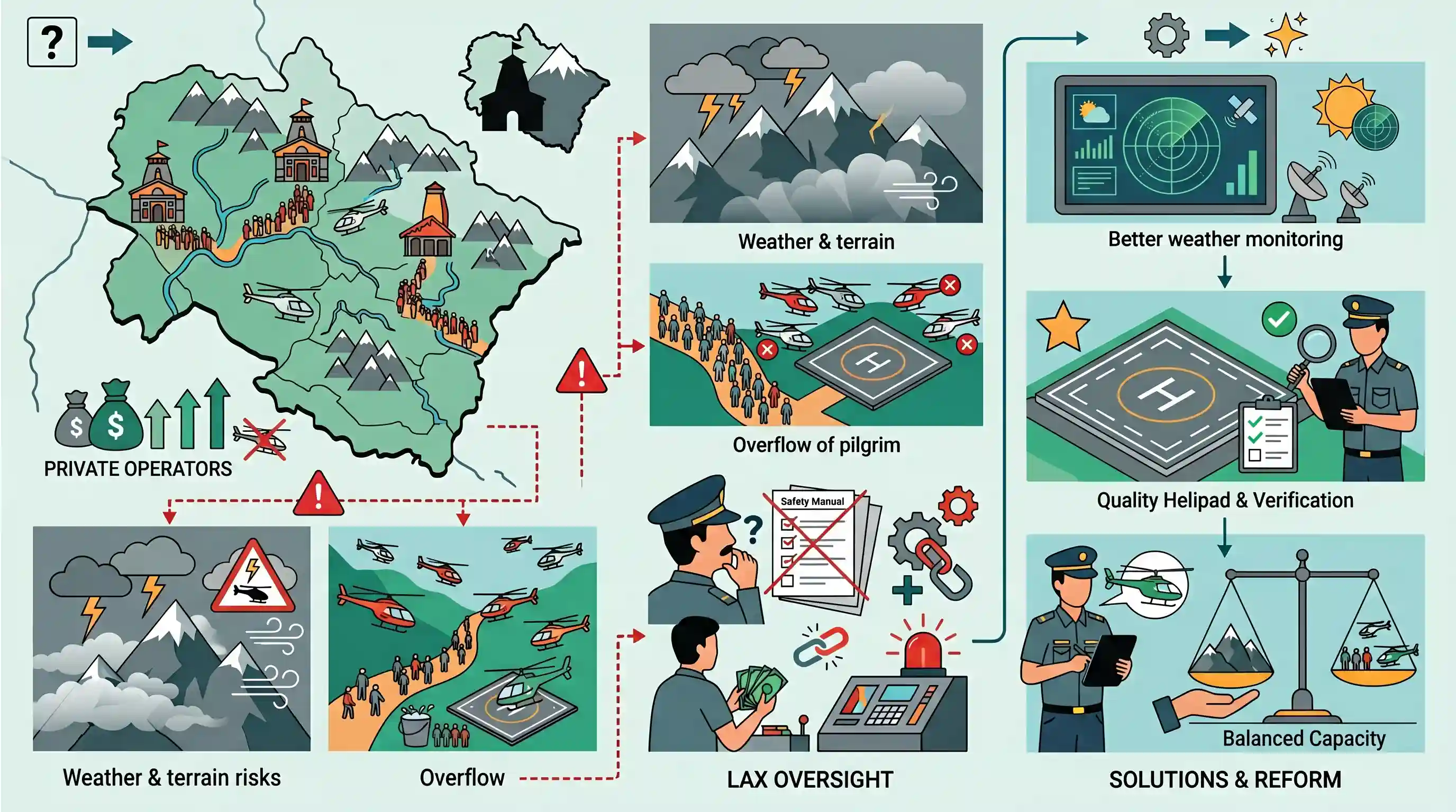
The article examines the systemic issues plaguing the private aviation sector in Uttarakhand, brought to the forefront by recent helicopter crashes. It highlights how the combination of treacherous Himalayan terrain, unpredictable weather, and the heavy influx of pilgrims for the Char Dham Yatra creates a high-risk environment for aerial transport. Private operators frequently flout safety regulations to maximize profits, while inadequate infrastructure and lax oversight by authorities like the DGCA compound the dangers. The situation underscores the urgent need for stringent aviation safety enforcement, better weather monitoring, and adherence to the ecological and infrastructural carrying capacity of hill states.
Key Points
- Mountainous terrains like Uttarakhand experience sudden micro-climatic changes, making helicopter navigation highly risky.
- Private operators often bypass safety norms and standard operating procedures (SOPs) to maximize sorties and profits during peak pilgrimage seasons.
- There are significant regulatory and oversight gaps by the Directorate General of Civil Aviation (DGCA) in enforcing strict safety protocols in remote hilly areas.
- Inadequate aviation infrastructure, such as limited real-time weather monitoring and insufficient helipads, exacerbates the danger of flying in ecologically fragile regions.
- The unregulated rush of religious tourism puts immense pressure on regional infrastructure, underscoring the need to respect the carrying capacity of sensitive mountain ecosystems.
Important Terms
Directorate General of Civil Aviation (DGCA)

The statutory body regulating civil aviation in India, responsible for enforcing safety standards, licensing personnel, and investigating accidents to ensure airworthiness and operational safety.
UPSC context
GS2 Regulatory Bodies. Essential for evaluating aviation safety frameworks and regulatory oversight in infrastructure development.
UDAN Scheme
A regional connectivity scheme launched to make air travel affordable by subsidizing flights to underserved airports, with a special focus on developing heliports in remote and hilly regions.
UPSC context
GS3 Infrastructure. Tests understanding of balanced regional growth and connectivity initiatives in geographically challenging terrains.
Uttarakhand Civil Aviation Development Authority (UCADA)
The nodal agency for developing aviation infrastructure in Uttarakhand, responsible for managing helipads and tendering helicopter services for pilgrims and disaster management.
UPSC context
GS2 State Governance. Relevant for discussing state-specific infrastructure management and disaster relief coordination in hill states.
Char Dham Yatra
A major Hindu pilgrimage circuit to the Himalayan shrines of Yamunotri, Gangotri, Kedarnath, and Badrinath, driving seasonal tourism and infrastructure demand in Uttarakhand.
UPSC context
GS1 Culture/GS3 Environment. Tests knowledge of religious heritage and the environmental impact of mass tourism in fragile ecosystems.
Carrying Capacity
The maximum level of population or activity an ecosystem can sustain without degradation; used to measure the sustainability of tourism and infrastructure in fragile regions.
UPSC context
GS3 Environment. Critical for analyzing sustainable development, urban planning, and ecological limits in sensitive mountain regions.
Prelims Trap
"The DGCA is an executive, non-statutory body under the Ministry of Civil Aviation."
DGCA was originally an executive body, but it was officially elevated to a statutory body following the enactment of the Aircraft (Amendment) Act, 2020.
Static Concepts Connected
What is the GAGAN system and its aviation utility?
- Developers: Jointly developed by ISRO and Airports Authority of India (AAI) as a Satellite-Based Augmentation System (SBAS).
- Function: Enhances GPS navigational accuracy, which is crucial for precision aircraft landing and safe helicopter operations in treacherous terrains like the Himalayas.
How is 'Carrying Capacity' applied to Himalayan ecology?
- Definition: The maximum tourism, population, or infrastructure load a fragile ecosystem can sustain without suffering irreversible environmental degradation.
- Governance Context: Frequently invoked by the Supreme Court and NGT to halt unchecked infrastructure expansion in vulnerable hill states like Uttarakhand following disasters.
Cross-Topic Patterns
UDAN Scheme vs. Ecological Limits
The push for the Regional Connectivity Scheme (RCS-UDAN) in hill states creates direct friction between aviation infrastructure integration and the ecological carrying capacity of the Himalayas.
Mass Congregations & NDMA Guidelines
The unregulated Char Dham rush connects directly to NDMA guidelines on crowd management, mass congregations, and disaster preparedness at religious sites in vulnerable topographies.

Expect a multi-statement Prelims question mixing Himalayan carrying capacity, GAGAN navigation capabilities, and DGCA's statutory status.
Linked PYQs · 4
Linked PYQs · 4
- 2019MainsGS3
Define the concept of carrying capacity of an ecosystem as relevant to an environment. Explain how understanding this concept is vital while planning for sustainable development of a region.
- 2016MainsGS3
Rehabilitation of human settlements is one of the important environmental impacts which always attracts controversy while planning major projects. Discuss the measures to be adopted to mitigate the impact of the recent incidents of cloudbursts in many places of Uttarakhand.
- 2025PrelimsGS1
GPS-Aided Geo Augmented Navigation (GAGAN) uses a system of ground stations to provide necessary augmentation. Which of the following statements is/are correct in respect of GAGAN? I. It is designed to provide additional accuracy and integrity. II. It will allow more uniform and high quality air traffic management. III. It will provide benefits only in aviation but not in other modes of transportation. Select the correct answer using the code given below.
- 2024MainsGS3
What is disaster resilience? How is it determined? Describe various elements of a resilience framework. Also mention the global targets of Sendai Framework for Disaster Risk Reduction (2015–2030).
