Char Dham Yatra suspended as heavy rain and landslides hit Uttarakhand
Source:etv-bharat ↗
Why It Matters
Uttarakhand's high vulnerability to natural calamities like landslides and heavy rains significantly impacts its economy and pilgrimage sectors. Understanding the state's geography, including the locations of the Char Dham shrines and the districts affected by extreme weather, is essential for UKPSC PCS Prelims candidates.
Summary
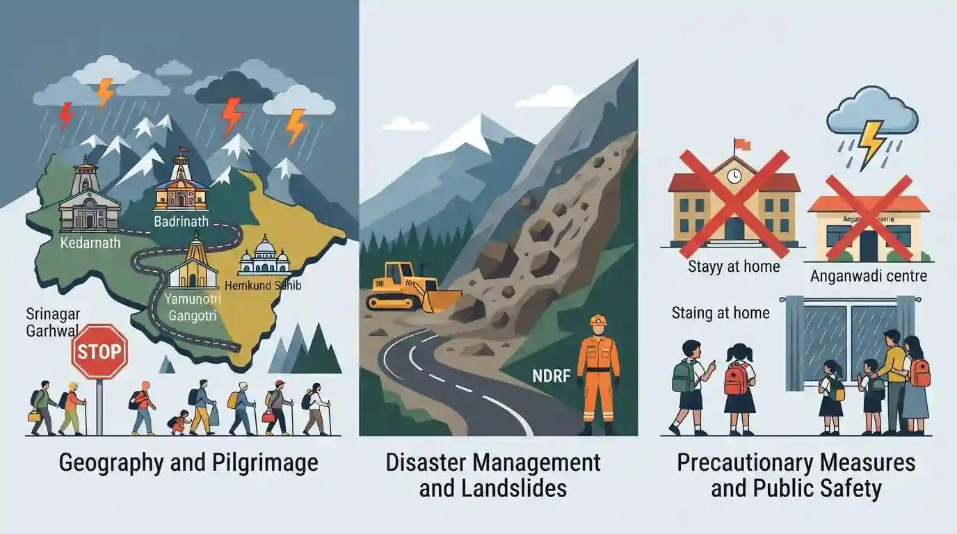
The Char Dham Yatra in Uttarakhand has been temporarily suspended due to torrential rains and a high risk of landslides. The India Meteorological Department (IMD) issued red and orange alerts across the state, prompting authorities to halt pilgrims en route to the Kedarnath, Badrinath, Gangotri, Yamunotri, and Hemkund Sahib shrines at safe checkpoints like Srinagar Garhwal. In response to the perilous weather conditions, schools and Anganwadi centres in 11 districts were closed as a precautionary measure to ensure public safety.
Key Points
- The Char Dham Yatra in Uttarakhand has been temporarily suspended due to severe heavy rainfall and landslides.
- Pilgrims traveling to the prominent shrines of Kedarnath, Badrinath, Gangotri, Yamunotri, and Hemkund Sahib have been halted at safe checkpoints.
- The India Meteorological Department (IMD) has issued red and orange alerts indicating heavy downpours across various regions of the state.
- As a precautionary measure against the adverse weather conditions, schools and Anganwadi centres across 11 districts have been closed.
Important Terms
Char Dham Yatra

A sacred Hindu pilgrimage circuit in the Indian Himalayas of Uttarakhand, consisting of four holy shrines: Yamunotri, Gangotri, Kedarnath, and Badrinath.
UPSC context
GS Paper I (Art & Culture) and GS Paper III (Environment); tests religious geography and disaster vulnerability in hilly terrains.
India Meteorological Department (IMD)
The principal government agency under the Ministry of Earth Sciences responsible for meteorological observations, weather forecasting, and issuing early warnings for extreme weather.
UPSC context
GS Paper III (Science & Technology, Disaster Management); tests institutional role in early weather warnings and climate monitoring.
National Disaster Response Force (NDRF)
A specialized federal force established under the Disaster Management Act, 2005, operating under the Ministry of Home Affairs to respond to severe disasters.
UPSC context
GS Paper III (Disaster Management); tests administrative frameworks, emergency coordination, and national crisis response mechanisms.
State Disaster Response Force (SDRF)
A state-level emergency rescue unit and financial fund established under the Disaster Management Act, 2005, serving as the first responder to localized disasters.
UPSC context
GS Paper III (Disaster Management); tests decentralized emergency mechanisms, cooperative federalism, and local-level mitigation strategies.
Prelims Trap
The Uttarakhand Char Dham circuit of Yamunotri, Gangotri, Kedarnath, and Badrinath represents the original four cardinal sites established by Adi Shankaracharya.
Shankaracharya established the national Char Dham (Badrinath, Dwarka, Puri, Rameswaram). The Uttarakhand circuit is the Chhota Char Dham, a regional sub-pilgrimage corridor.
Static Concepts Connected
What are the geographical confluences (Panch Prayag) of the Alaknanda river system?
- Vishnuprayag: Alaknanda meets the Dhauliganga River.
- Karnaprayag: Alaknanda meets the Pindar River.
- Rudraprayag: Alaknanda meets the Mandakini River originating from Kedarnath.
- Devprayag: Alaknanda meets the Bhagirathi River to officially form the Ganga.
Why are the Himalayan slopes highly susceptible to frequent mass wasting?
- Tectonic instability: Active tectonic upliftment makes geological structures highly fractured and seismically vulnerable.
- Exogenic forces: Torrential monsoon rainfall triggers high pore-water pressure, inducing sudden slope failures.
- Anthropogenic stress: Unscientific slope cutting for roads and tunnels compromises fragile hill slope stability.
Cross-Topic Patterns
Himalayan connectivity vs Ecological carrying capacity
Infrastructure projects like the Char Dham highway showcase the tension between regional strategic connectivity and the fragile carrying capacity of Eco-Sensitive Zones in high-altitude zones.
Disaster mitigation and early warning systems
Combining IMD color warnings with community SDRF deployments reflects the transition from reactive relief to proactive disaster risk reduction under the Sendai Framework.

Confluences of the Panch Prayag combined with the geological vulnerability of the Main Central Thrust (MCT) likely to feature in 2026.
Linked PYQs · 4
Linked PYQs · 4
- 2016UKPSC_PRELIMSGS1
Which one of the following shrines of Uttarakhand was visited by maximum number of tourists in the year 2015?
- 2025UKPSC_PRELIMSGS1
The Silkyara Tunnel spanning ______ is expected to shorten the distance between Gangotri and Yamunotri above 20 km .
- 2025UKPSC_PRELIMSGS1
Consider the following statements and select the correct answer from the options given below : Statement 1 : Uttarakhand is highly vulnerable to climate change. Statement 2 : Climate change is causing water stress and depleting biodiversity in Uttarakhand.
- 2007UKPSC_PRELIMSGS1
Which of the following Natural Calamity has the most devastating impact in Uttarakhand State?
