New tunnel and bridge near completion on Char Dham highway route
Source:india-today ↗
Why It Matters
The Char Dham Yatra is critical to Uttarakhand's tourism economy, but heavy traffic on fragile mountain roads causes massive bottlenecks. This infrastructure upgrade represents a significant milestone in disaster-resilient regional connectivity, making the pilgrimage safer and boosting the local economy—themes heavily tested in UKPSC geography and economy sections.
Summary
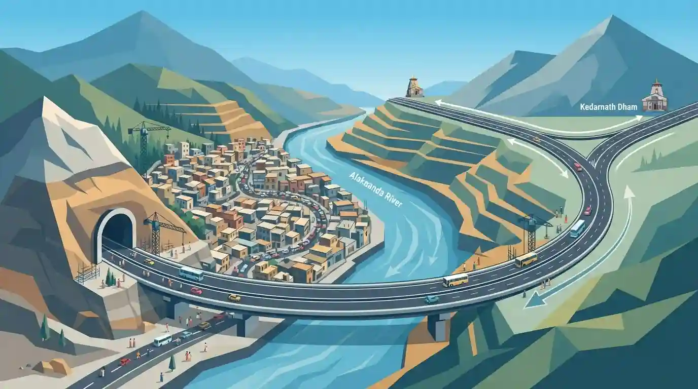
A new 900-metre tunnel and a 200-metre double-lane bridge over the Alaknanda River are nearing completion in Rudraprayag, Uttarakhand. Constructed under the Char Dham Pariyojana at a cost of ₹156 crore, the project connects the Badrinath and Kedarnath highways. By bypassing the narrow, congested roads of Rudraprayag market, it will streamline traffic and provide a much smoother journey for pilgrims undertaking the annual Char Dham Yatra.
Key Points
- A 900-metre tunnel linking the Badrinath and Kedarnath highways is nearing completion in Uttarakhand's Rudraprayag district.
- The infrastructure project also includes a 200-metre-long double-lane motor bridge built over the Alaknanda River.
- Built at an estimated cost of ₹156 crore under the Char Dham Pariyojana, the tunnel will bypass the congested Rudraprayag market.
- The development aims to significantly reduce traffic bottlenecks and ensure a smoother commute for pilgrims during the annual Char Dham Yatra.
Important Terms
Char Dham Mahamarg Vikas Pariyojana

An infrastructure initiative to widen approximately 900 km of national highways in Uttarakhand. It provides improved all-weather connectivity to the four holy shrines: Badrinath, Kedarnath, Gangotri, and Yamunotri.
UPSC context
GS-3 (Infrastructure/Environment). Crucial for examining the conflict between strategic/developmental infrastructure and Himalayan ecological fragility.
Alaknanda River
A major headstream of the Ganga originating from the Satopanth glacier in Uttarakhand. It flows through the Panch Prayags, meeting the Mandakini at Rudraprayag and the Bhagirathi at Devprayag.
UPSC context
GS-1 (Geography). Tests knowledge of Himalayan river systems, drainage basin patterns, and geographical mapping.
Rudraprayag
A town in Uttarakhand situated at the confluence of the Mandakini and Alaknanda rivers. It is one of the sacred "Panch Prayags" and a key transit point for Himalayan pilgrims.
UPSC context
GS-1 (Geography/Culture). Important for mapping questions regarding river confluences (Panch Prayag) and cultural geography.
Char Dham Yatra
An annual Hindu pilgrimage circuit in the Indian Himalayas, covering the four high-altitude holy shrines of Badrinath, Kedarnath, Gangotri, and Yamunotri in Uttarakhand.
UPSC context
GS-1 (Art & Culture) & GS-3 (Environment). Highlights cultural significance while testing the ecological impacts of mass pilgrimage tourism.
Prelims Trap
The Supreme Court strictly capped Char Dham highway widths at 5.5 meters nationwide, rejecting all defense-related widening requests due to Himalayan fragility.
In 2021, the Supreme Court permitted a wider 12-meter Double-Lane Paved Shoulder (DL-PS) configuration on three strategic stretches, prioritizing national security and border defense logistics.
Static Concepts Connected
What are the five holy confluences (Panch Prayag) of the Alaknanda River system?
- Vishnuprayag & Nandaprayag: Vishnuprayag marks the confluence with Dhauliganga, while Nandaprayag is the junction where Nandakini meets Alaknanda.
- Karnaprayag & Rudraprayag: Karnaprayag is where the Pindar River merges, and Rudraprayag hosts the confluence of Mandakini with Alaknanda.
- Devprayag: The final confluence where Alaknanda joins Bhagirathi to flow onwards as the Ganga River.
What is the dual mandate of the Border Roads Organisation (BRO)?
- Administrative Control: Functioning under the Ministry of Defence, BRO constructs strategic road infrastructure along India's northern and eastern frontiers.
- Strategic-Civilian Link: It balances tactical military mobility requirements near international borders with socio-economic integration of remote, isolated communities.
Cross-Topic Patterns
Himalayan Geology vs Strategic Mobility
Balancing strategic border infrastructure needs along the LAC with the ecological vulnerability of the young, seismically active Himalayan fold mountains.
Disaster Resilient Infrastructure
Designing tunnels and bridges in high-altitude zones prone to glacial lake outbursts, cloudbursts, and landslides under Sendai Framework guidelines.

Strategic border infrastructure (DL-PS standards) paired with Himalayan river confluences (Panch Prayag) is a high-probability Prelims 2026 target.
Linked PYQs · 3
Linked PYQs · 3
- 2007UKPSC_PRELIMSGS1
Name the river which flows between Kedarnath | Rudra Prayag?
- 2025UKPSC_PRELIMSGS1
As per Uttarakhand Budget 2025-26, the amount allocated for Char Dham Road network improvement is
- 2025UKPSC_PRELIMSGS1
Which of the following is the correct order of rivers from west to east in Uttarakhand?
