High Level Bridge Project over Sukhna Choe in Chandigarh
Source:Indian Express ↗
Why It Matters
Demonstrates practical implementation of disaster-resilient infrastructure to mitigate urban flooding impacts, a recurring theme in UPSC GS3. It highlights sustainable urban transport solutions, including non-motorized transport provisions like cycle tracks.
Summary
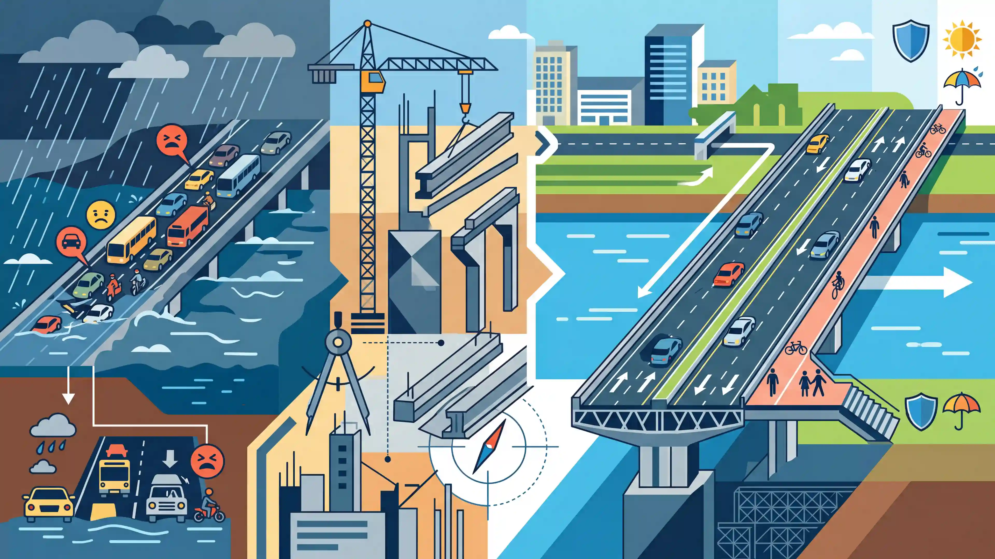
The Chandigarh administration has greenlit a Rs 16.63 crore project to construct a high-level bridge over Sukhna Choe, replacing a narrow, flood-prone causeway that links Manimajra to Sector-26. The new infrastructure will provide uninterrupted, all-weather connectivity and eliminate traffic bottlenecks, particularly during monsoons when the choe overflows. The bridge will feature dual four-lane carriageways, dedicated footpaths, cycle tracks, and advanced flood-resilient engineering like RCC and precast technology to improve commuter safety and urban mobility.
Key Points
- The Chandigarh administration approved a Rs 16.63 crore high-level bridge over Sukhna Choe to connect Manimajra and Sector-26.
- The bridge replaces a flood-prone vented causeway that frequently flooded during the monsoon, disrupting daily traffic to key locations like Sukhna Lake, PGI, and the High Court.
- The project features dual four-lane carriageways with dedicated footpaths and cycle tracks, aimed at reducing congestion and boosting non-motorized transport.
- Design incorporates Advanced Reinforced Cement Concrete (RCC), precast technology, efficient drainage systems, and flood-resilient measures to ensure all-weather connectivity.
Important Terms
Sukhna Choe

A seasonal stream originating from the Shivalik Hills that drains Chandigarh's Sukhna Lake into the Ghaggar River. It is a critical drainage channel prone to overflowing during monsoons.
UPSC context
GS Paper 1 (Geography); GS Paper 3 (Disaster Management). Tests knowledge of local drainage systems and urban flood causes.
High-Level Bridge
A bridge structure designed with its deck above the maximum flood level to ensure uninterrupted traffic flow, unlike low-level causeways that submerge during heavy rains.
UPSC context
GS Paper 3 (Infrastructure). Focuses on climate-resilient engineering solutions for flood-prone regions.
Urban Flooding
The inundation of property in built-up environments caused by rainfall overwhelming the capacity of drainage systems, often exacerbated by unplanned urbanization and encroachment of natural channels.
UPSC context
GS Paper 3 (Disaster Management). A frequent mains topic regarding climate-induced disasters and NDMA guidelines.
Urban Resilience
The capacity of a city to withstand, adapt to, and recover quickly from shocks like floods or heatwaves while maintaining essential services and infrastructure.
UPSC context
GS Paper 1 (Urbanization); Geography Optional. Tests understanding of sustainable urban planning and disaster mitigation.
All-Weather Connectivity
Road or transport links designed to remain functional under all climatic conditions, particularly during extreme weather like monsoons, preventing economic and social disruption.
UPSC context
GS Paper 3 (Economy/Infrastructure). Relevant for schemes like PMGSY and Bharat Mala regarding regional development.
Chandigarh Master Plan 2031
A comprehensive planning document outlining the city's growth, land use, and infrastructure development up to 2031, with a focus on heritage conservation and sustainable expansion.
UPSC context
GS Paper 1 (Urbanization). Example of planned urban growth and the challenges of modernizing heritage cities.
Prelims Trap
"Sukhna Lake is a natural wetland fed by perennial Himalayan rivers."
Sukhna is actually an artificial, rain-fed reservoir created by damming a seasonal stream (Sukhna Choe), not a natural or perennial water body.
Static Concepts Connected
What are "Choes" in the context of Indian physical geography?
- Ephemeral streams: Seasonal, fast-flowing ephemeral streams originating in the Shivalik foothills, highly prominent in Punjab and Haryana.
- Erosion agents: They carry heavy, sudden runoff during monsoons, causing severe gully erosion, soil degradation, and localized flash floods.
What are the core principles of the National Urban Transport Policy (NUTP)?
- People over vehicles: Shifts the focus from facilitating personal motor vehicles to prioritizing public transit and moving people efficiently.
- Non-Motorized Transport: Mandates dedicated infrastructure for pedestrians and cyclists in urban road projects to boost sustainable mobility.
- Transit-Oriented Development: Integrates land use and transport planning to minimize travel distances and ease urban congestion.
Cross-Topic Patterns
Shivalik geomorphology meets urban flooding
The unique topography of Shivalik "choes" creates flash-flood vulnerabilities in downhill planned cities like Chandigarh, linking physical geography directly to urban disaster management.
Precast infra for climate resilience
Shifting to precast RCC technology minimizes on-site dust pollution (aligning with NCAP goals) and allows faster deployment of flood-resilient structures before monsoon windows close.

Expect a Prelims geography pair-matching question on local drainage terms (like 'Choes' or 'Khad') linked to their respective regions.
Linked PYQs · 4
Linked PYQs · 4
- 2024MainsGS3
Flooding in urban areas is an emerging climate-induced disaster. Discuss the causes of this disaster. Mention the features of two such major floods in the last two decades in India. Describe the policies and frameworks in India that aim at tackling such floods.
- 2024MainsGS3
What is disaster resilience? How is it determined? Describe various elements of a resilience framework. Also mention the global targets of Sendai Framework for Disaster Risk Reduction (2015–2030).
- 2021MainsGS3
“Investment in infrastructure is essential for more rapid and inclusive economic growth.” Discuss in the light of India's experience.
- 2019MainsGS1
How is efficient and affordable urban mass transport key to the rapid economic development of India?
