NAKSHA Project Pilot Land Survey in Chandigarh Villages
Source:Indian Express ↗
Why It Matters
The digitisation and modernisation of land records are critical aspects of e-governance and land reforms in India. Projects like NAKSHA and SVAMITVA illustrate the practical application of emerging technologies (GIS, Drones) in solving historical governance deficits like unclear property rights and litigation, directly addressing UPSC topics on transparency, accountability, and technology applications.
Summary
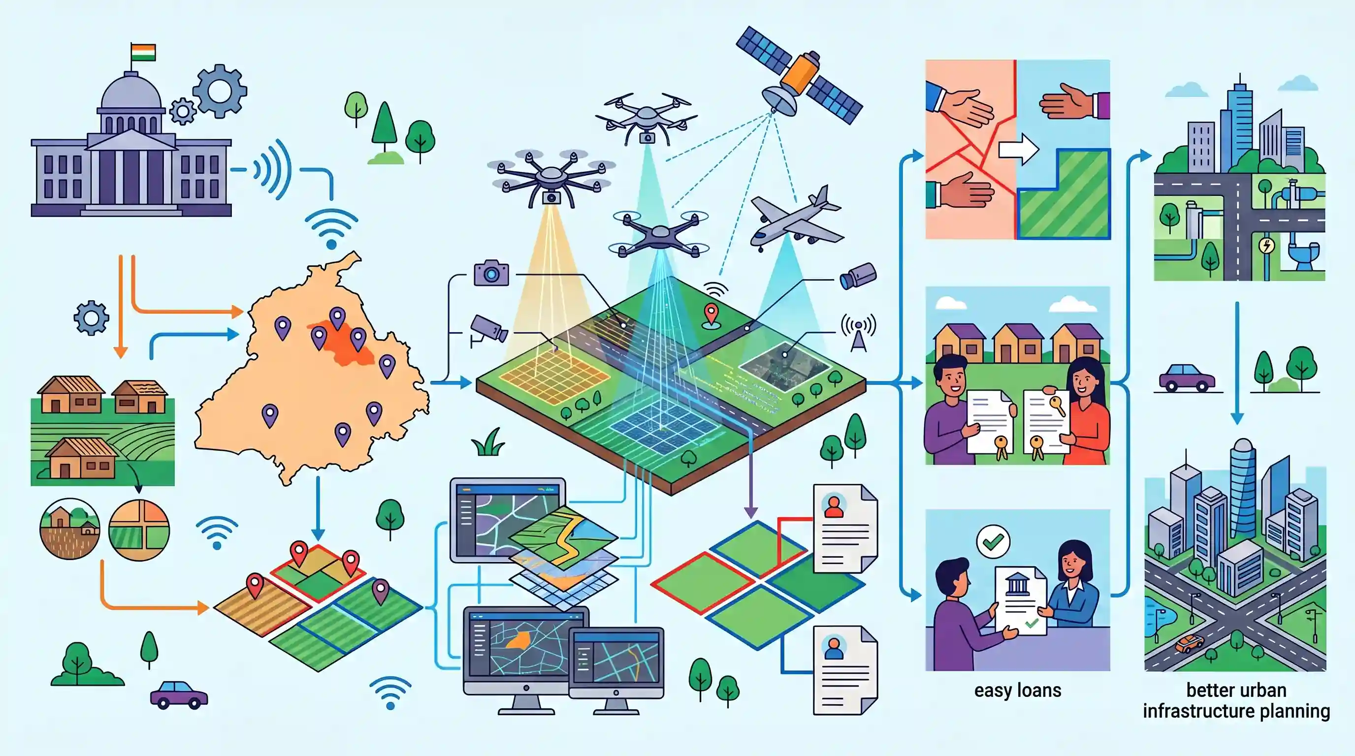
The Centre's NAKSHA project has selected five villages in Chandigarh for a pilot land survey utilizing advanced geospatial technologies. Managed by the Department of Land Resources (DoLR) under the Ministry of Rural Development, the project builds upon the Digital India Land Records Modernisation Programme (DILRMP). Through drone surveys, high-resolution imagery, and GIS mapping, NAKSHA aims to accurately delineate land parcels and link them directly to ownership details. This technological intervention is expected to modernise land governance by resolving overlapping claims, issuing clear property titles, easing bank loan approvals, and facilitating better urban infrastructure planning.
Key Points
- The Centre has selected five villages in Chandigarh for a pilot land survey under the NAKSHA (National Geospatial Knowledge-based Land Survey of Urban Habitations) project.
- NAKSHA is executed by the Department of Land Resources (DoLR) and builds upon the Digital India Land Records Modernisation Programme (DILRMP).
- The initiative leverages modern geospatial technologies like drone surveys, high-resolution imagery, and GIS mapping to accurately delineate urban land parcels.
- The project aims to modernise land governance, issue clear property titles, resolve overlapping claims, and ensure transparent property ownership.
- Clear property titles will facilitate easier access to bank loans and boost real estate activity while aiding urban infrastructure planning.
Important Terms
NAKSHA Project

Stands for National Geospatial Knowledge-based Land Survey of Urban Habitations. A 2024 pilot project under DILRMP to modernize urban land records using drones and GIS mapping across selected cities.
UPSC context
GS Paper 2 (Governance/e-Governance) and GS Paper 3 (Land Reforms). Tests knowledge of urban land management and technology in administration.
Digital India Land Records Modernisation Programme (DILRMP)
A Central Sector Scheme (revamped 2016) aimed at digitizing land records, automating mutations, and integrating textual/spatial data to minimize disputes and move towards conclusive land-titling.
UPSC context
GS Paper 3 (Land Reforms). Core topic for questions on digital governance and modernizing India's complex land administration system.
Department of Land Resources (DoLR)
The nodal department under the Ministry of Rural Development responsible for land reforms, DILRMP, and watershed management. It coordinates land policy and technical modernization with states.
UPSC context
GS Paper 2 (Ministries and Departments). Important for understanding the institutional framework of land governance and rural development.
Geospatial Technology
Advanced tools like GPS, GIS, and remote sensing used to collect, analyze, and map location-based data. In NAKSHA, it enables high-resolution imagery and precise parcel delineation.
UPSC context
GS Paper 3 (Science and Technology/Land Reforms). Relevant for topics on the application of emerging technologies in public service delivery.
SVAMITVA Scheme
A Central Sector Scheme (launched 2020) by the Ministry of Panchayati Raj using drone technology to map rural residential (Abadi) lands and provide legal 'Record of Rights' to owners.
UPSC context
GS Paper 2 (Governance). Often compared with NAKSHA to distinguish between rural (SVAMITVA) and urban (NAKSHA) land surveying initiatives.
Prelims Trap
"Because NAKSHA surveys urban habitations, it is implemented by the Ministry of Housing and Urban Affairs."
NAKSHA surveys urban habitations but is surprisingly implemented by the Department of Land Resources under the Ministry of Rural Development, not MoHUA.
Static Concepts Connected
Conclusive vs. Presumptive Land Titling in India
- Presumptive Titling: India's current system; land registration acts as a record of transaction, not a state-guaranteed proof of ownership. Title is subject to challenge.
- Conclusive Titling: The State guarantees the land title and offers compensation for errors. Schemes like DILRMP and NAKSHA build the digital foundation to shift to this system.
Digital India Land Records Modernization Programme (DILRMP)
- Core Objective: Aims to computerize land records, integrate spatial and textual records, and establish a modern land management system.
- Nodal Agency: It is a Central Sector Scheme operating under the Department of Land Resources (DoLR), Ministry of Rural Development.
- ULPIN Integration: Introduced the Unique Land Parcel Identification Number (ULPIN), also known as Bhu-Aadhaar, to provide a 14-digit ID for surveyed land parcels.
Cross-Topic Patterns
SVAMITVA vs NAKSHA spatial mapping
SVAMITVA maps rural 'Abadi' areas under the Ministry of Panchayati Raj, while NAKSHA maps urban habitations but counter-intuitively falls under the Ministry of Rural Development.
Geospatial Data Liberalisation 2021
Drone mapping projects like NAKSHA leverage the 2021 deregulation of geospatial data, which ended the Survey of India's mapping monopoly and allowed broad public-private sector involvement.

Expect a Prelims question pairing SVAMITVA and NAKSHA to test their counter-intuitive nodal ministries (MoPR vs MoRD).
Linked PYQs · 3
Linked PYQs · 3
- 2023MainsGS3
State the objectives and measures of land reforms in India. Discuss how land ceiling policy on landholding can be considered as an effective reform under economic criteria.
- 2023MainsGS2
e-governance, as a critical tool of governance, has ushered in effectiveness, transparency and accountability in governments. What inadequacies hamper the enhancement of these features ?
- 2024MainsGS2
e-governance is not just about the routine application of digital technology in service delivery process. It is as much about multifarious interactions for ensuring transparency and accountability. In this context evaluate the role of the 'Interactive Service Model' of e-governance.
