Mining Ban in Aravalli Protected Zones to Prevent Desertification
Source:Indian Express ↗
Why It Matters
The degradation of the Aravalli range poses a severe ecological threat, including the potential desertification of the fertile northern plains and the National Capital Region. This development serves as a critical case study for UPSC aspirants regarding the conflict between economic development (mining) and ecological conservation, the role of the judiciary in environmental protection, and the geographical significance of mountain ranges as climatic barriers.
Summary
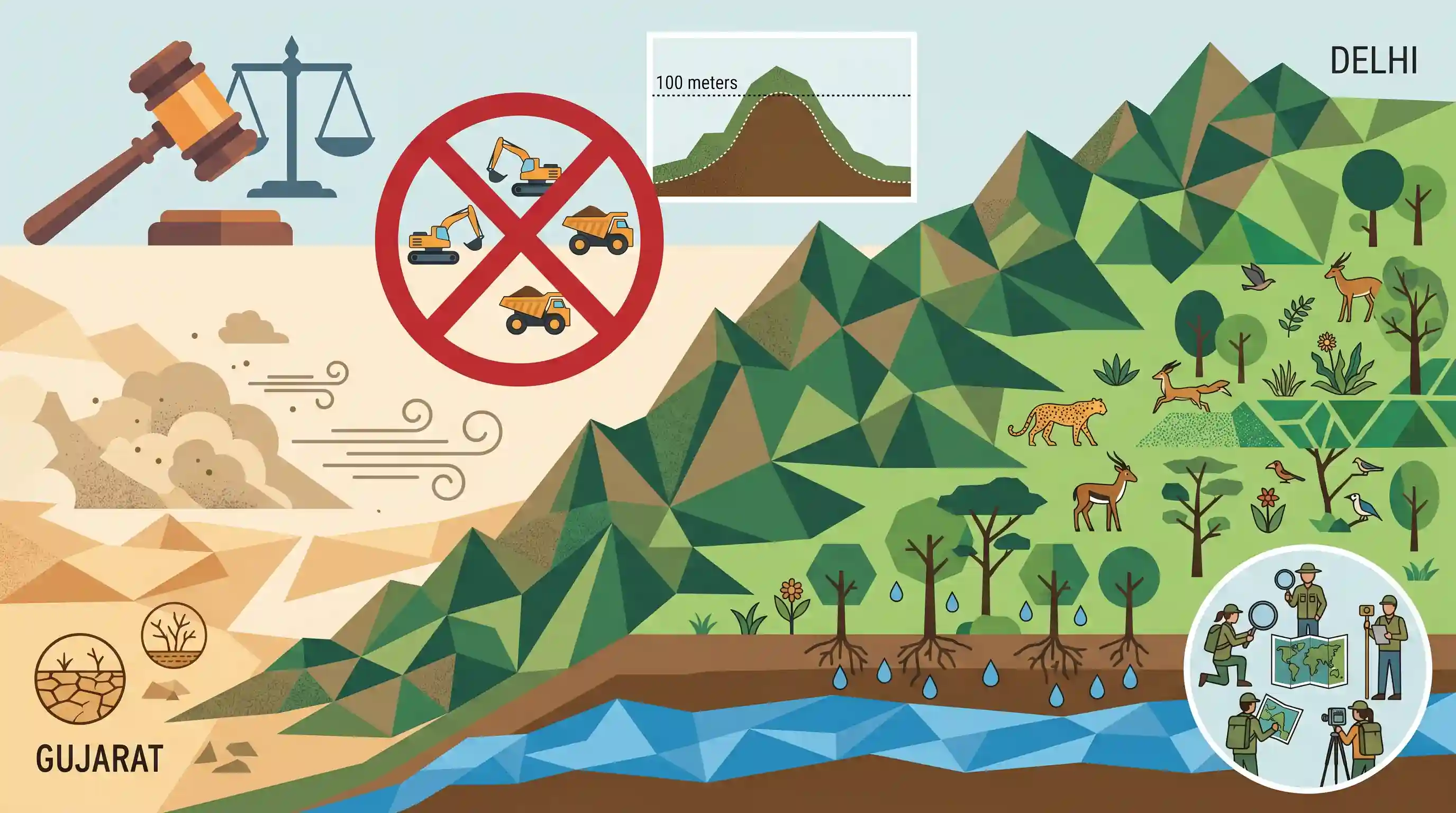
The Union Ministry of Environment, Forest and Climate Change (MoEFCC) has imposed a complete ban on granting new mining leases in the Aravalli range. This decision aligns with the Supreme Court's acceptance of the Forest Survey of India's definition of the Aravalli Hills, encompassing elevations of 100 meters or more above local relief. The ban aims to protect the continuous geological formation stretching from Gujarat to Delhi, which serves as a crucial barrier against the eastward expansion of the Thar Desert. The measure is intended to combat desertification, conserve biodiversity, and protect vital groundwater aquifers. The Indian Council of Forestry Research and Education (ICFRE) will identify further areas for mining prohibition.
Key Points
- The MoEFCC has imposed a complete ban on granting new mining leases across the Aravalli range to protect its ecological integrity.
- The Supreme Court accepted the Forest Survey of India\'s definition of Aravalli Hills as any hill with an elevation of 100 meters or more above local relief.
- The ban is primarily aimed at preventing the eastward expansion of the Thar Desert into the fertile northern plains and the NCR.
- The Aravalli range acts as a critical climatic and geological barrier, essential for conserving biodiversity and recharging groundwater aquifers.
- The Indian Council of Forestry Research and Education (ICFRE) has been tasked with identifying additional areas where mining should be prohibited.
Important Terms
Union Ministry of Environment, Forest and Climate Change (MoEFCC)

The nodal central ministry responsible for planning, promoting, and coordinating environmental, forestry, and climate change programs. It implements key legislations like the Environment (Protection) Act, 1986, and oversees conservation and pollution control.
UPSC context
GS Paper III (Environment); essential for understanding institutional mechanisms, environmental clearances, and India's international climate commitments (UNFCCC/UNCCD).
Supreme Court of India
The highest judicial body in India that interprets environmental laws and exercises Public Interest Litigation (PIL) powers. It often issues landmark directives to protect ecologically fragile zones like the Aravallis.
UPSC context
GS Paper II (Judiciary) and III (Environment); tests knowledge of judicial activism and the 'Public Trust Doctrine'.
Forest Survey of India (FSI)
A premier national organization under MoEFCC tasked with regular assessment and monitoring of India's forest resources. It publishes the biennial 'India State of Forest Report' (ISFR) using satellite data.
UPSC context
GS Paper III (Environment) and Geography; a primary source for forest cover data and ecological assessment metrics.
Indian Council of Forestry Research and Education (ICFRE)
An autonomous body under MoEFCC that coordinates forestry research, education, and extension. It provides scientific advice to the government on sustainable forest management and environmental impact assessments.
UPSC context
GS Paper III (Environment); focuses on the role of scientific institutions in policy formulation and ecological restoration.
Aravalli Range
One of the world's oldest fold-mountain systems, stretching from Gujarat to Delhi. It acts as a natural buffer against desertification and is vital for groundwater recharge in North India.
UPSC context
GS Paper I (Geography) and III (Environment); critical for studying geomorphology, regional climate, and conservation challenges.
Desertification
The process of land degradation in arid and semi-arid regions. The Aravallis serve as a 'Green Wall' to prevent the eastward spread of the Thar Desert into the Indo-Gangetic plains.
UPSC context
GS Paper I (Geography) and III (Environment); aligns with UNCCD goals and India's 'Land Degradation Neutrality' targets.
Prelims Trap
The Supreme Court definition extends legal protection to 100% of the Aravalli range.
The 100m elevation above local relief criteria actually excludes nearly 90% of smaller hillocks and extensions from protection, sparking activist concerns about mining loopholes.
Static Concepts Connected
What is the geological and geographical significance of the Aravalli Range?
- Old Fold Mountains: It is a highly denuded relic of one of the world's oldest fold mountain systems, formed during the Proterozoic era.
- Geographical Extent: It stretches approximately 692 km from Palanpur in Gujarat, through Rajasthan and Haryana, ending at Raisina Hill in Delhi.
- Climatic Barrier: It acts as a water divide between the Indus and Ganga basins, and serves as a physical barrier halting the eastward expansion of the Thar desert.
What is the Indian Council of Forestry Research and Education (ICFRE)?
- Autonomous Body: It is an autonomous council under the Ministry of Environment, Forest and Climate Change (MoEFCC), headquartered in Dehradun.
- Core Mandate: It directs forestry research, transfers technologies, advises the government on forest policies, and drafts specialized conservation and management plans.
Cross-Topic Patterns
UNCCD targets and Aravalli desertification barrier
The Great Green Wall of Aravalli project and this mining ban directly align with India's UNCCD commitment to restore 26 million hectares of degraded land by 2030.
Judicial definition of ecological entities
Similar to the Godavarman case defining "forests", the Supreme Court is legally defining what constitutes a "hill" (100m relief) to mandate environmental protections.

Expect a multi-statement Prelims question testing Aravalli geography (extent, fold-nature) mapped against the FSI's 100m hill definition.
Linked PYQs · 3
Linked PYQs · 3
- 2025MainsGS3
Mineral resources are fundamental to the country's economy and these are exploited by mining. Why is mining considered an environmental hazard? Explain the remedial measures required to reduce the environmental hazard due to mining.
- 2012MainsGS1
Examine the causes and the extent of 'desertification' in India and suggest remedial measures.
- 2020MainsGS1
The process of desertification does not have climatic boundaries. Justify with examples.
