Myanmar earthquake aftershocks and humanitarian crisis
Source:The Hindu ↗
Why It Matters
The event highlights the cascading impacts of natural disasters in conflict-ridden regions, a critical case study for disaster management, relief operations, and geopolitics in India's immediate neighbourhood.
Summary
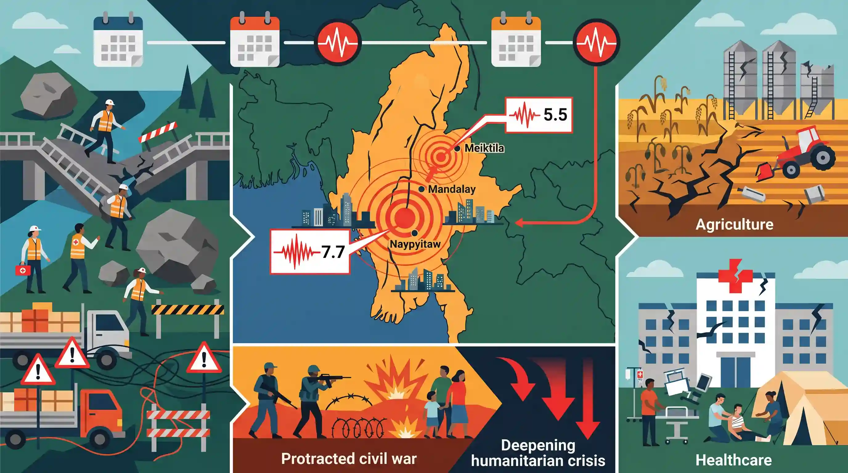
A 5.5 magnitude earthquake struck central Myanmar near Meiktila on April 13, 2025, acting as a major aftershock to the devastating 7.7 magnitude quake from March 28. The epicentre was located between Mandalay and Naypyitaw. The compounding natural disasters are severely worsening Myanmar's ongoing humanitarian crisis, which has already been triggered by a protracted civil war. The earthquakes have severely disrupted agricultural production and destroyed critical medical facilities, deeply complicating relief efforts.
Key Points
- A 5.5 magnitude earthquake, a major aftershock of the March 28 7.7 magnitude quake, struck central Myanmar on April 13, 2025.
- The epicentre was located near Meiktila, situated between Mandalay and Naypyitaw.
- The seismic events are severely compounding the humanitarian crisis already fueled by Myanmar's ongoing civil war.
- The disasters have caused significant damage to medical facilities and disrupted agricultural production in the region.
Prelims Trap
Myanmar's earthquakes are purely caused by the frontal collision of the Indian and Eurasian plates.
Myanmar's primary seismic zone is the Sagaing Fault, which is a strike-slip fault between the Indian and Sunda plates, not a frontal thrust collision like the Himalayas.
Static Concepts Connected
How does the Sagaing Fault drive seismicity in Myanmar?
- Strike-slip mechanism: It is a major right-lateral transform fault where tectonic plates slide horizontally past one another, rather than colliding head-on.
- Plate boundaries: It accommodates the continuous tectonic motion between the Indian Plate and the micro-Sunda Plate.
- High vulnerability: It runs north-south through Myanmar's central basin, putting major population centres like Mandalay and Naypyitaw at extreme seismic risk.
What constitutes a "Compound Disaster" in disaster management?
- Definition: The simultaneous or sequential occurrence of multiple natural or human-induced hazards in the same geographic region.
- Cascading vulnerability: Pre-existing crises (like Myanmar's civil war) degrade infrastructure and governance, crippling standard response mechanisms and amplifying natural shocks.
- Sendai Framework mandate: Managing compound disasters requires integrated risk reduction and structural resilience, a core priority of the Sendai Framework.
Cross-Topic Patterns
IMT Highway & seismic infrastructure risks
Meiktila is a vital junction for the India-Myanmar-Thailand Trilateral Highway. These earthquakes highlight the urgent need for disaster-resilient infrastructure investments under India's Act East Policy.
Border security + disaster refugees
The fusion of natural disasters and civil war severely compounds humanitarian suffering, increasing the likelihood of mass refugee influxes into India's Northeast, testing border management.

Expect a Prelims map question linking Meiktila to the IMT Highway, or a Mains question on managing compound disasters in conflict zones.
Linked PYQs · 3
Linked PYQs · 3
- 2021MainsGS3
Discuss about the vulnerability of India to earthquake related hazards. Give examples including the salient features of major disasters caused by earthquakes in different parts of India during the last three decades.
- 2019MainsGS3
Vulnerability is an essential element for defining disaster impacts and its threat to people. How and in what ways can vulnerability to disasters be characterized? Discuss different types of vulnerability with reference to disasters.
- 2022MainsGS2
India is an age-old friend of Sri Lanka.’ Discuss India's role in the recent crisis in Sri Lanka in the light of the preceding statement.
