Urban Heatwaves and Climate Resilience in Indian Cities
Source:The Hindu ↗
Why It Matters
The increasing frequency of urban flooding and heatwaves presents a dual challenge for Indian cities, posing significant risks to public health and infrastructure. Understanding data-driven disaster mitigation (like GIS and Climate Risk Observatories) is vital for GS-3 (Environment and Disaster Management), as it aligns with the evolving focus on climate-resilient urban planning.
Summary
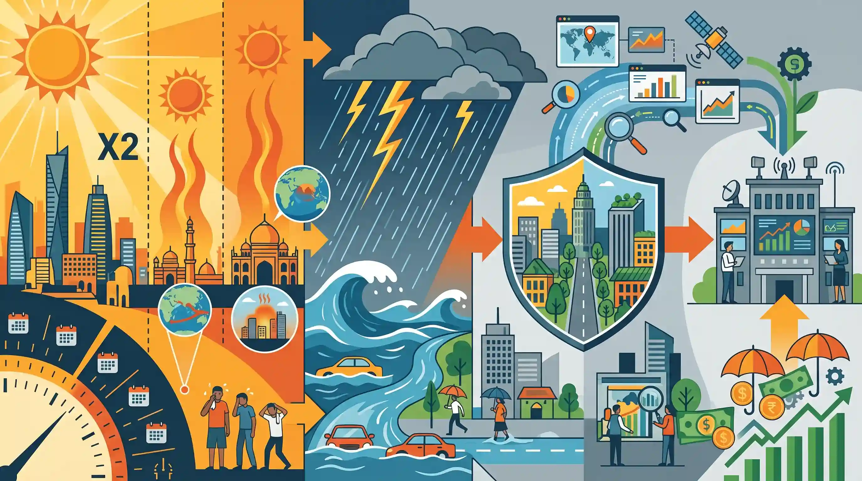
A recent study by IPE Global and Esri India, titled 'Weathering the Storm: Managing Monsoons in a Warming Climate', predicts a two-fold increase in heatwave days for eight major Indian cities by 2030. It reveals a clear correlation between extended heatwaves and subsequent erratic, intense rainfall. Exacerbated by phenomena such as El Nino and local microclimatic shifts, these extreme weather events demand urgent urban resilience measures. The study advocates for a data-driven approach utilizing Geographic Information Systems (GIS), the establishment of a Climate Risk Observatory (CRO) for granular risk assessment, and innovative risk-financing instruments to bolster India's disaster management framework.
Key Points
- A study by IPE Global and Esri India projects a two-fold increase in heatwave days for major Indian cities like Mumbai, Delhi, and Chennai by 2030.
- Climate change is expected to trigger a 43% rise in the intensity of extreme rainfall events across India, making the country both hotter and wetter.
- Microclimatic changes caused by local drivers (like land-use changes and deforestation) and macro phenomena (El Nino and La Nina) are significantly amplifying extreme weather events.
- The study recommends using Geographic Information System (GIS) technology for spatial intelligence and proactive disaster response.
- Key policy recommendations include establishing a Climate Risk Observatory (CRO) for hyper-granular risk assessment and creating heat-risk-champions within district disaster management committees.
Important Terms
UNFCCC

An international environmental treaty (1992) aimed at stabilizing atmospheric greenhouse gas concentrations to prevent dangerous anthropogenic interference with the climate system.
UPSC context
GS Paper 3: Environment/Climate Change. Core for international negotiations, COPs, and India’s global climate commitments.
PARIVESH
A web-based single-window portal (MoEFCC) for online submission and monitoring of proposals seeking environmental, forest, wildlife, and Coastal Regulation Zone (CRZ) clearances.
UPSC context
GS Paper 2: Governance/E-governance. Streamlining environmental impact assessments and ease of doing responsible business.
Jal Jeevan Mission
A flagship Indian mission launched in 2019 to provide safe and adequate drinking water through individual household tap connections to all rural households by 2024.
UPSC context
GS Paper 2: Social Justice/Schemes. Vital for rural development, health, and climate-resilient water resource management.
IPE Global
An international development consultancy that provides technical assistance and research on climate change, disaster management, and urban resilience in the Global South.
UPSC context
GS Paper 3: Disaster Management. Exemplifies the role of specialized consultancies in climate risk assessment and urban adaptation.
Esri India
The Indian arm of the global leader in Geographic Information System (GIS) software, providing spatial analytics and location intelligence for disaster risk reduction.
UPSC context
GS Paper 3: Science & Technology. Highlights the application of GIS technology in climate-risk mapping and disaster management.
Clean Ganga
Formally known as Namami Gange, it is an integrated conservation mission to achieve effective abatement of pollution and rejuvenation of the National River Ganga.
UPSC context
GS Paper 3: Environment. Key for water pollution control, river ecosystem restoration, and sustainable urban drainage.
Prelims Trap
Global warming will make India strictly drier, confining heatwaves exclusively to the pre-monsoon months.
Climate change extends summer-like heat into the monsoon season, altering atmospheric dynamics to trigger a surge in extreme, intense rainfall events—making cities both hotter and wetter.
Static Concepts Connected
What are the primary drivers of the Urban Heat Island (UHI) effect?
- Concrete and Asphalt: Materials with high thermal mass absorb and retain daytime solar radiation, releasing it slowly at night.
- Reduced Evapotranspiration: Deforestation and wetland loss in cities eliminate the natural cooling effect provided by vegetation and water bodies.
- Urban Canyons: Tall buildings trap long-wave radiation and obstruct natural wind flows, preventing heat dissipation.
What are the IMD criteria for declaring a heatwave in India?
- Base Thresholds: The maximum temperature of a station must reach at least 40°C for plains and 30°C for hilly regions.
- Departure Criteria: A heatwave is declared if the departure from normal temperature is 4.5°C to 6.4°C (Severe if >6.4°C).
- Absolute Criteria: A heatwave is declared when the actual maximum temperature hits 45°C or more (Severe if ≥47°C), regardless of the normal.
Cross-Topic Patterns
Heatwaves triggering Urban Flooding
Extended heatwaves reduce soil moisture and bake the earth, lowering infiltration capacity. When extreme rainfall follows, surface runoff surges rapidly, triggering severe urban flash floods.
GIS in Climate Governance
The study's push for a Climate Risk Observatory connects GS3 disaster management with GS3 S&T, highlighting how Earth Observation data and GIS are crucial for micro-level hazard zonation.

Expect a GS1/GS3 question linking the Urban Heat Island effect directly to erratic monsoon rainfall and subsequent urban flash floods.
Linked PYQs · 4
Linked PYQs · 4
- 2014MainsGS1
Most of the unusual climatic happenings are explained as an outcome of the El-Nino effect. Do you agree?
- 2024MainsGS3
Flooding in urban areas is an emerging climate-induced disaster. Discuss the causes of this disaster. Mention the features of two such major floods in the last two decades in India. Describe the policies and frameworks in India that aim at tackling such floods.
- 2024MainsGS3
What is disaster resilience? How is it determined? Describe various elements of a resilience framework. Also mention the global targets of Sendai Framework for Disaster Risk Reduction (2015–2030).
- 2019MainsGS3
Disaster preparedness is the first step in any disaster management process. Explain how hazard zonation mapping will help disaster mitigation in the case of landslides.
