Basin-Wide Transboundary Cooperation for Flood Management in Bihar
Source:Indian Express ↗
কেন এটি গুরুত্বপূর্ণ
This article is crucial for understanding the geographical, ecological, and diplomatic dimensions of disaster management and transboundary river governance in South Asia, frequently featured in GS Paper I (Disaster Management/Geography) and GS Paper II (International Relations).
সারসংক্ষেপ
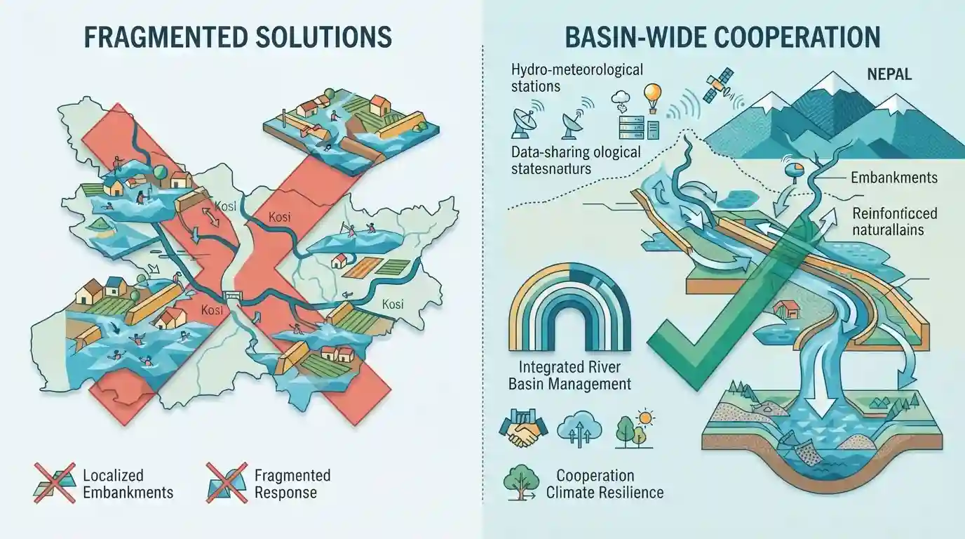
The editorial emphasizes that recurring floods in Bihar cannot be effectively mitigated through fragmented, localized solutions or over-reliance on embankments. It calls for comprehensive basin-wide cooperation between India and upper-riparian neighbors like Nepal, improved hydro-meteorological data sharing, and a strategic shift toward integrated river basin management to address siltation, climate change impacts, and recurrent humanitarian crises.
মূল বিষয়
- Annual floods in Bihar highlight the critical limitations of structural interventions like embankments, which often trap silt, raise river beds, and exacerbate disaster risks.
- Effective flood management requires a shift from localized, reactive engineering to integrated basin-wide cooperation involving upper-riparian countries like Nepal and neighboring states.
- Transboundary data sharing regarding rainfall, hydrological flows, and early warning systems is vital to mitigate loss of life and property in downstream regions.
- Climate change has intensified extreme weather events, making traditional disaster response frameworks inadequate and necessitating long-term ecological restoration and comprehensive watershed management.
গুরুত্বপূর্ণ শব্দ
India Meteorological Department (IMD)

The national meteorological service of India responsible for weather forecasting, meteorological observations, and issuing weather-related warnings, including heavy rainfall alerts that aid in flood management and disaster preparedness.
UPSC context
GS Paper III (Disaster Management) - Important institutional mechanisms and forecasting agencies for extreme weather events and floods.
Nepal Government
The central government of Nepal, an upper-riparian neighbor whose territory encompasses Himalayan river sources that significantly impact downstream flood dynamics and transboundary water management in northern India.
UPSC context
GS Paper II (International Relations) & GS Paper III (Disaster Management) - Bilateral water diplomacy, transboundary river cooperation, and regional disaster mitigation.
প্রিলিমস ফাঁদ
structural interventions like embankments permanently solve flood risks in downstream states
Aspirants often assume that structural interventions like embankments permanently solve flood risks, whereas geography questions frequently test how embankments trap silt and worsen riverbed aggradation.
সংযুক্ত স্থির ধারণা
What are the key principles of Integrated River Basin Management (IRBM)?
- Holistic Scope: Water resources managed in context of political & administrative boundaries within a river basin.
- Data Sharing: Involves sharing real-time hydrological and hydro-meteorological data across riparian jurisdictions.
- Ecological Shift: Shifts focus from reactive engineering (embankments) to watershed restoration & ecological health.
আন্তঃবিষয় প্যাটার্ন
Transboundary Water + Climate Diplomacy
Transboundary water management routinely intersects with bilateral diplomacy, territorial security, and climate adaptation financing under international frameworks like UNFCCC.
Disaster Management + Human Development
Frequent flood disasters in Bihar directly undermine rural resilience and agricultural productivity, feeding back into multi-dimensional poverty indices and state fiscal stress.

Transboundary river governance + upper-riparian cooperation (India-Nepal) is a high-yield area for Mains GS-1 (Geography) & GS-3 (Disaster Management).
সংযুক্ত PYQ · 3
সংযুক্ত PYQ · 3
- 2017MainsGS1
In what way can floods be converted into a sustainable source of irrigation and all-weather inland navigation in India?
- 2020MainsGS1
The interlinking of rivers can provide viable solutions to the multi-dimensional inter-related problems of droughts, floods and interrupted navigation. Critically examine.
- 2016PrelimsGS1
Which of the following are the key features of 'National Ganga River Basin Authority (NGRBA)? 1. River basin is the unit of planning and management. 2. It spearheads the river conservation efforts at the national level. 3. One of the Chief Ministers of the States through which the Ganga flows becomes the Chairman of NGRBA on rotation basis. Select the correct answer using the code given below.
