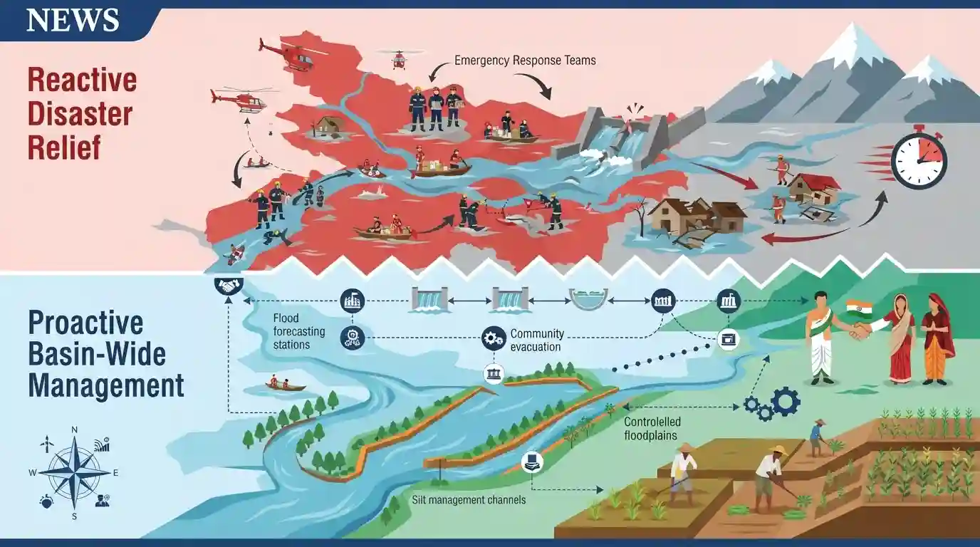
Basin Wide Approach Adopted for Bihar Flood Management
Source:ensureias ↗
Why It Matters
Crucial for understanding Bihar's recurring natural disasters, geographical challenges, and administrative policy frameworks aimed at flood mitigation.
Summary
The article discusses the transition of flood management strategies in Bihar from reactive disaster relief to proactive, basin-wide flood management, emphasizing inter-state and international cooperation with Nepal, silt management, and holistic structural and non-structural interventions.
Key Points
- Bihar experiences severe annual flooding, particularly in its northern plains due to rivers originating in Nepal such as the Kosi, Gandak, and Bagmati.
- Basin-wide flood management requires cross-border cooperation between India and Nepal, improved silt management, and comprehensive watershed approaches rather than just embankment construction.
- Embankments often lead to bed aggradation and drainage congestion, exacerbating long-term flood vulnerabilities.
- Integrating river-linking projects like Kosi-Mechi can aid in flood moderation and regional irrigation.
Important Terms
Kosi Mechi Link Project

An intra-state river linking project in Bihar designed to divert surplus water from the Kosi River to the Mechi River to enhance irrigation in Seemanchal districts and mitigate regional flooding.
UPSC context
Important for BPSC/UPSC Prelims and Mains (Bihar Geography, Water Resources); tests knowledge of river interlinking and flood mitigation schemes in north Bihar.
Central Water Commission
India's apex technical organization under the Ministry of Jal Shakti responsible for coordinating water resource development, flood forecasting, and techno-economic appraisal of river projects.
UPSC context
Relevant for BPSC/UPSC General Studies (Indian Polity, Environment & Governance); tests institutional frameworks for flood forecasting and water resource management.
Bihar Water Resources Department
The nodal department of the Government of Bihar tasked with flood management, embankment maintenance, irrigation infrastructure creation, and resolution of inter-state river water sharing issues.
UPSC context
Crucial for BPSC Main Exam (Bihar-specific governance, disaster management, and rural infrastructure); tests understanding of state-level institutional interventions in flood control.
Prelims Trap
Construction of long linear embankments completely eliminates annual flooding in the North Bihar plains.
Aspirants often assume embankments permanently solve floods, but static geography notes show they cause bed aggradation and drainage congestion over time.
Static Concepts Connected
What are the major geographical causes and characteristics of the North Bihar flood menace?
- Himalayan Origin: Himalayan Origins: Rivers like Kosi, Gandak, and Bagmati originate in steep, unstable Himalayan ranges in Nepal, carrying massive silt loads.
- Kosi Siltation: Sorrow of Bihar: The Kosi River is infamous for shifting its course westward due to heavy sediment deposition, triggering sudden devastating floods.
- Flat Topography: Topographical Flatness: Once these rivers enter the North Bihar plains, the sudden drop in slope causes rapid deposition of silt, raising river beds.
Cross-Topic Patterns
North Bihar Floods & Indo-Nepal Hydro-Diplomacy
Frequent floods in North Bihar tie directly into the broader geography of Himalayan river systems and transboundary diplomacy between India and Nepal.
River Interlinking & Agrarian Resilience
Intra-state interlinking projects like Kosi-Mechi connect disaster mitigation goals directly with agrarian irrigation expansion in the Seemanchal region.

Expect a multi-statement question on the limitations of linear embankments and the role of Indo-Nepal cooperation in Bihar flood management.
Linked PYQs · 2
Linked PYQs · 2
- 2024-IBPSC_PRELIMSGS1
Which river is known as the ‘Sorrow of Bihar’?
- 2025BPSC_PRELIMSGS1
Which districts in Bihar will benefit from the Kosi Mechi Link Project?
