Bihar Basin Wide Flood Management and River Governance
Source:ensureias ↗
Why It Matters
Crucial for understanding Bihar's recurring natural disasters, geographical challenges of North Bihar rivers, and structural policy solutions required for sustainable state development.
Summary
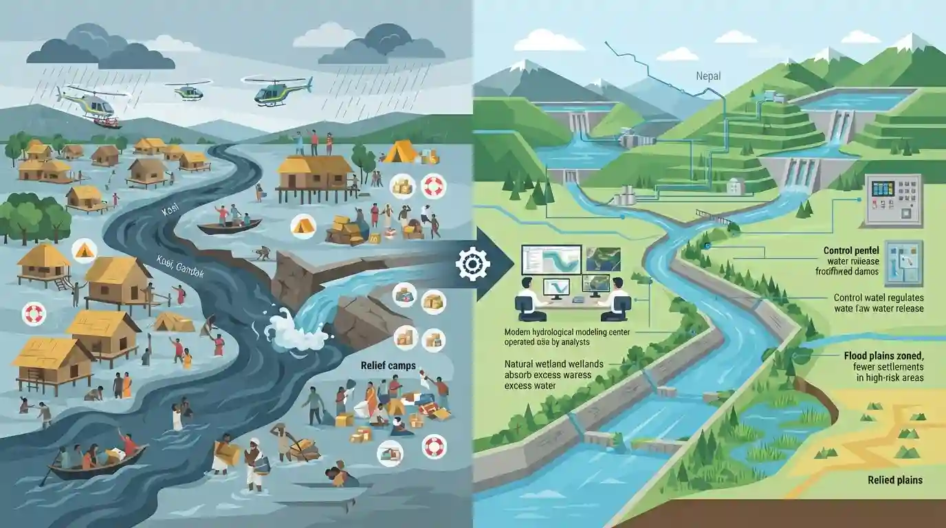
The article discusses the transition of flood management strategies in Bihar from reactive disaster relief to a strategic, basin-wide approach. Given that North Bihar's rivers originate in Nepal and carry massive silt loads, effective flood mitigation requires Indo-Nepal transboundary cooperation, better reservoir operations, and modern hydrological modeling rather than merely relying on embankments.
Key Points
- Bihar faces severe annual flooding, primarily driven by rivers originating in Nepal such as the Kosi, Gandak, Bagmati, and Kamla.
- Shifting from localized embankments and reactive disaster relief to comprehensive basin-wide flood management is critical.
- Basin-wide management requires cross-border cooperation with Nepal for hydrological data sharing, reservoir regulation, and silt management.
- Integration of modern technology, weather forecasting, real-time data monitoring, and watershed management can significantly reduce flood vulnerabilities in North Bihar.
Important Terms
Kosi-Mechi Interlinking Project

An intra-state river linking initiative designed to divert surplus waters from the Kosi River to the Mechi River to enhance irrigation across four North Bihar districts and aid regional flood mitigation.
UPSC context
BPSC Mains (Geography/Economy): Tests knowledge of major river-interlinking projects, agricultural infrastructure schemes, and sustainable basin management in Bihar.
Indo-Nepal Water Resources Cooperation
Bilateral diplomatic and technical engagement between India and Nepal focusing on joint reservoir operations, flood forecasting, and high dams to control Himalayan rivers entering North Bihar.
UPSC context
BPSC Mains (International Relations/Geography): Tests transboundary water diplomacy, bilateral treaties, and collaborative regional disaster management strategies.
Central Water Commission
The premier national technical organisation under the Ministry of Jal Shakti responsible for hydrological observations, flood forecasting, and monitoring river basins across India, including Bihar's flood-prone network.
UPSC context
BPSC Prelims/Mains (Polity/Geography): Tests institutional frameworks for disaster management, flood early warning systems, and national water data management.
Prelims Trap
Embankments alone are a permanent and foolproof solution for eliminating floods in North Bihar.
Aspirants often assume embankments are a permanent standalone solution, whereas expert consensus emphasizes that aging embankments can trap silt and worsen drainage congestion.
Static Concepts Connected
What are the major north-flowing river basins of Bihar and their key characteristics?
- Kosi River: Kosi Basin known for frequent channel shifting ('Sorrow of Bihar') and heavy silt deposition originating in Nepal.
- Gandak River: Gandak Basin features major hydroelectric and irrigation projects like the Tribeni Canal and Valmiki Nagar barrage.
- Bagmati and Kamla: Bagmati & Kamla originate in Mahabharat range, causing flash floods in North-Central Bihar due to low carrying capacity.
Cross-Topic Patterns
Geography of Bihar + Agricultural Irrigation Security
Bihar's North-South geographic divide makes water resource management a recurring theme spanning both physical geography and agricultural productivity in the state mains syllabus.
Transboundary Water Diplomacy + Regional Security
Indo-Nepal river treaties reflect wider geopolitical dynamics, linking bilateral water diplomacy with regional disaster risk reduction strategies.

BPSC mains GS-2/GS-1 often asks for a shift from reactive disaster relief to basin-wide water management in Bihar; expect structural questions.
Linked PYQs · 3
Linked PYQs · 3
- 2024-EBPSC_PRELIMSGS1
Which of the following drainage systems drains the lands of Bihar?
- 2023BPSC_PRELIMSGS1
Bihar’s geographical structure consists of rock systems. Match the rock systems with their descriptions: a. Dharwar rock system 1. Created by the rapid deposition of alluvium by Himalayan and Peninsular rivers b. Vindhyan rock system 2. Can be found in the West Champaran district c. Quaternary rock system 3. Part of the oldest Archaean rock system d. Tertiary rock system 4. Sandstone, limestone, dolomite, quartzite and shale are the main constituents of this rock system Select the correct answer using the codes given below.
- 2020BPSC_PRELIMSGS1
Which of the following rivers flowing in Bihar is a north flowing river?
