Bihar Basin Wide Flood Management Strategy and Challenges
Source:ensureias ↗
Why It Matters
Floods are a recurring socio-economic and humanitarian crisis in Bihar. Understanding basin-wide management strategies is critical for aspirants focusing on state-specific geography, governance, and disaster resilience.
Summary
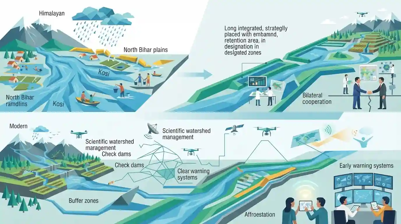
The article examines the perennial issue of floods in Bihar, shifting the policy focus from reactive emergency management and fragmented embankments to a comprehensive, basin-wide flood management framework. It highlights the geographical vulnerability of North Bihar plains due to Himalayan rivers originating in Nepal, the ecological limitations of embankments, and the necessity for bilateral cooperation, scientific watershed management, and advanced forecasting.
Key Points
- Bihar is India's most flood-prone state, with over 70% of its total geographical area in the north affected by floods.
- Traditional structural measures like embankments have often led to drainage congestion and sediment trapping rather than preventing floods entirely.
- A shift from reactive disaster response to basin-wide flood management, integrating Nepal-India cooperation, is essential for long-term mitigation.
- Modern approaches include real-time data sharing, wetland conservation, afforestation in upper catchments, and improved drainage systems.
Prelims Trap
Embankments are permanent engineering solutions that completely eliminate flood risks in North Bihar plains.
Aspirants often assume embankments permanently prevent floods in North Bihar, overlooking how they can cause drainage congestion and permanent waterlogging.
Static Concepts Connected
What are the major Himalayan river systems causing annual floods in North Bihar?
- Kosi River: Kosi River: Known as the 'Sorrow of Bihar', originating in Tibet/Nepal, notorious for shifting its course westward.
- Gandak & Bagmati: Gandak & Bagmati: Himalayan rivers bringing massive silt loads and causing severe flash floods during monsoons.
- Mahananda River: Mahananda River: Easternmost Himalayan tributary joining the Ganga in Katihar district.
Cross-Topic Patterns
Bihar Floods + Rural Agrarian Economy
Bihar's seasonal inundation patterns deeply impact rural agrarian economies, mirroring how agricultural credit and monsoon dependencies are examined in Indian Economy static syllabus.
Kosi/Gandak Treaties + Indo-Nepal Diplomacy
Transboundary water disputes between India and Nepal connect regional disaster planning with bilateral treaty frameworks studied under International Relations.

Expect a multi-statement Prelims question on North Bihar river geography, silt loads, and the ecological limits of embankments.
Linked PYQs · 2
Linked PYQs · 2
- 2020BPSC_PRELIMSGS1
Which of the following rivers flowing in Bihar is a north flowing river?
- 2024-EBPSC_PRELIMSGS1
Which of the following drainage systems drains the lands of Bihar?
