Bennehalla Flood Control Project Launched in North Karnataka
Source:The Hindu ↗
Why It Matters
This article offers a tangible case study for GS3 Disaster Management on how states leverage mechanisms like the State Disaster Mitigation Fund (SDMF) for structural flood mitigation rather than just post-disaster relief. Additionally, the geographical details of the Bennihalla-Malaprabha-Krishna river network are highly relevant for GS1 Prelims mapping questions on peninsular drainage.
Summary
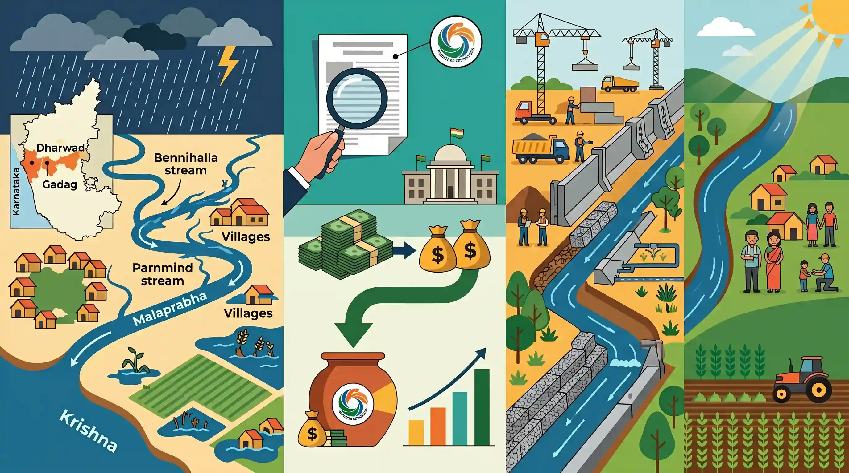
The Karnataka government has initiated the Bennehalla flood control project to mitigate severe flash floods affecting 37 villages in the Dharwad and Gadag districts. The Bennihalla stream, which merges into the Malaprabha river (a tributary of the Krishna river), frequently overflows during monsoons, damaging over 20,000 hectares of agricultural land. Based on the G.S. Paramashivayya report and conforming to Central Water Commission guidelines, the ₹1,610-crore project will construct barrier walls and protective infrastructure. The state has released an initial ₹200 crore from the State Disaster Mitigation Fund (SDMF) to commence the first phase, providing long-term disaster resilience for the region.
Key Points
- The Karnataka government has launched the Bennehalla flood control project to prevent recurring flash floods in 37 villages across the Dharwad and Gadag districts.
- An initial grant of ₹200 crore has been released from the State Disaster Mitigation Fund (SDMF) to execute the first phase of the project.
- The Bennihalla stream originates in Haveri district and flows into the Malaprabha river (a tributary of the Krishna river) near Menasagi village.
- The project, estimated to cost ₹1,610 crore in total, was drafted in accordance with the Central Water Commission (CWC) guidelines and the G.S. Paramashivayya report.
- Planned infrastructure includes barrier walls and embankments designed to protect over 20,000 hectares of agricultural land from monsoon inundation.
Important Terms
State Disaster Mitigation Fund (SDMF)

Established under Section 48(1)(c) of the Disaster Management Act, 2005, it provides dedicated financial resources for state-level projects aimed at reducing long-term disaster risks and impacts.
UPSC context
GS Paper III (Disaster Management). Tests knowledge of financial mechanisms for disaster risk reduction and 15th Finance Commission recommendations.
Central Water Commission (CWC)
An attached office of the Ministry of Jal Shakti, it is India’s premier technical organization for coordinating water resource conservation, flood control, and irrigation projects nationwide.
UPSC context
GS Paper II (Statutory/Regulatory Bodies) and GS III (Water Resources). Tests understanding of institutional frameworks for inter-state river management.
Malaprabha River
A major right-bank tributary of the Krishna River, originating in the Western Ghats (Karnataka). It is significant for the Navilatirtha Dam and UNESCO heritage sites on its banks.
UPSC context
GS Paper I (Indian Geography). Tests identification of river systems, their tributaries, and associated irrigation or cultural sites.
Krishna River
India's fourth-largest river, originating at Mahabaleshwar in Maharashtra and flowing through Karnataka, Telangana, and Andhra Pradesh before reaching the Bay of Bengal.
UPSC context
GS Paper I (Geography). Core topic for river basins, inter-state water disputes, and hydroelectric projects.
Disaster Management Act, 2005
The foundational legislation for India's institutional disaster management framework, mandating the creation of national, state, and district authorities (NDMA/SDMA) and specialized relief and mitigation funds.
UPSC context
GS Paper III (Disaster Management). A primary source for legal provisions regarding India's disaster response and mitigation strategies.
Bennehalla Stream
A key tributary of the Malaprabha River in Karnataka, prone to severe flash floods due to its flat gradient and high siltation during monsoon seasons.
UPSC context
GS Paper I (Regional Geography) and GS III (Disaster Management). Example of localized flood management and drainage basin issues.
Prelims Trap
SDMF provides funds solely for immediate post-disaster rescue and relief operations in affected villages.
The State Disaster Mitigation Fund (SDMF) is explicitly for proactive, pre-disaster structural/non-structural mitigation projects, whereas the SDRF is used for post-disaster response and relief.
Static Concepts Connected
What are the key tributaries of the Krishna River system?
- Right-bank tributaries: Key right-bank tributaries include the Ghataprabha, Malaprabha, and Tungabhadra, which originate in the Western Ghats.
- Left-bank tributaries: Key left-bank tributaries include the Bhima, Musi, and Munneru, primarily draining the Deccan Plateau region.
- Malaprabha confluence: The Malaprabha river, fed by streams like Bennihalla, ultimately joins the Krishna River at Kudalasangama in Karnataka.
How are state disaster funds structured under the 15th Finance Commission?
- SDRMF split: The State Disaster Risk Management Fund (SDRMF) was split into Response (SDRF - 80%) and Mitigation (SDMF - 20%).
- SDMF purpose: The SDMF is exclusively reserved for proactive measures like building barrier walls, embankments, and cyclone shelters to reduce future risk.
Cross-Topic Patterns
Topography's role in flash floods
A very flat river gradient slows discharge. When monsoons hit, sluggish streams like Bennihalla overflow instantly, linking physical geography directly to local disaster vulnerability.
CWC guidelines for intra-state flood control
While prominent in inter-state river dispute tribunals, the Central Water Commission (CWC) also provides essential technical and engineering guidelines for intra-state, state-funded flood mitigation projects.

Expect a multi-statement question on Krishna river tributaries (Malaprabha) paired with 15th FC disaster fund classifications (SDMF).
Linked PYQs · 4
Linked PYQs · 4
- 2023PrelimsGS1
Consider the following statements: 1. Jhelum River passes through Wular Lake. 2. Krishna River directly feeds Kolleru Lake. 3. Meandering of Gandak River formed Kanwar Lake. How many of the statements given above are correct?
- 2024MainsGS3
Flooding in urban areas is an emerging climate-induced disaster. Discuss the causes of this disaster. Mention the features of two such major floods in the last two decades in India. Describe the policies and frameworks in India that aim at tackling such floods.
- 2017MainsGS1
In what way can floods be converted into a sustainable source of irrigation and all-weather inland navigation in India?
- 2022MainsGS3
Explain the mechanism and occurrence of cloudburst in the context of the Indian subcontinent. Discuss two recent examples.
