Bagmati River Danger Mark Crossing Triggers Muzaffarpur Flood Alert
Source:theshillongtimes ↗
Why It Matters
Bihar's vulnerability to floods, especially in its northern plains due to rivers originating in Nepal, is a recurring geographical and disaster management theme. Understanding the state's drainage system (like the Bagmati, Gandak, and Burhi Gandak) is critical for BPSC Prelims Geography.
Summary
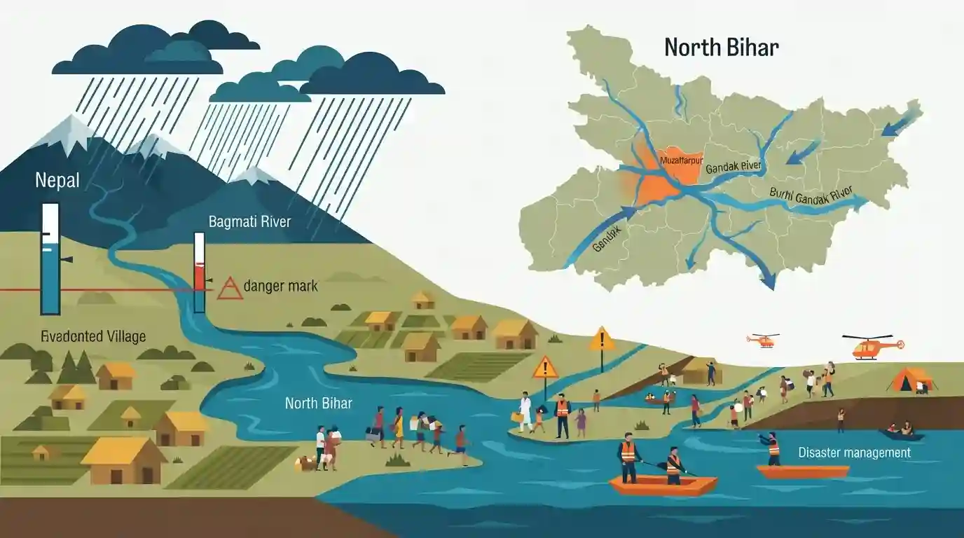
Heavy rainfall in Nepal has caused the Bagmati River to flow above the danger mark in Bihar's Muzaffarpur district, prompting local authorities to issue a flood alert. Other major rivers like the Gandak and Burhi Gandak are also experiencing rising water levels, posing significant inundation threats to North Bihar. The administration is actively urging residents in vulnerable, low-lying areas to evacuate as part of ongoing disaster management and mitigation efforts.
Key Points
- The Bagmati River has crossed the danger mark at Kataujha in Muzaffarpur district, Bihar, triggering a flood alert.
- Rising water levels in the Bagmati, Gandak, and Burhi Gandak rivers are attributed to continuous rainfall in the catchment areas of Nepal.
- The Gandak River is approaching the danger mark near Rewaghat, further threatening the low-lying areas of the district.
- The local administration has advised residents to evacuate low-lying zones as a precautionary measure to mitigate flood-related disasters.
Prelims Trap
Bagmati is a right-bank tributary of the Ganga originating in the Indian Himalayas.
Bagmati originates in Nepal's Shivapuri Hills, not India. Furthermore, it is part of the left-bank drainage system that empties into the Burhi Gandak, not a direct right-bank tributary.
Static Concepts Connected
How is the Ganga drainage system categorized in Bihar?
- Left-bank tributaries: Originate in the Himalayas (Gandak, Kosi, Bagmati, Burhi Gandak). They flow southwards, carry massive silt loads, and frequently cause floods.
- Right-bank tributaries: Originate in the Peninsular plateau (Son, Punpun, Phalgu). They flow northwards into the state, carry less silt, and are primarily rain-fed.
How do North Bihar rivers create wetlands like Kanwar Lake?
- Meandering rivers: High sediment loads combined with the extremely flat gradient of the North Bihar plains cause Himalayan rivers to meander excessively.
- Oxbow lake formation: When a meandering loop is cut off from the main river channel (e.g., Burhi Gandak), it leaves behind an oxbow lake like Kanwar Lake (Kabar Taal).
Cross-Topic Patterns
India-Nepal Hydro-diplomacy + Disasters
Bihar's flood mitigation is heavily dependent on bilateral water sharing and dam projects (like the proposed Kosi High Dam) in Nepal, linking disaster management directly to International Relations.
Fluvial Geomorphology + Ramsar Sites
The physical geography of shifting rivers directly shapes environmental ecology, as seen where the Burhi Gandak's abandoned meanders formed Kanwar Lake, a designated Ramsar wetland of international importance.

Expect a 2026 prelims question matching Ganga's left-bank tributaries to their transboundary origins and wetland formations (e.g., Kabartal).
Linked PYQs · 3
Linked PYQs · 3
- 2020BPSC_PRELIMSGS1
Which of the following rivers flowing in Bihar is a north flowing river?
- 2023BPSC_PRELIMSGS1
The other name of river Gandak is
- 2024-IBPSC_PRELIMSGS1
Which river is known as the ‘Sorrow of Bihar’?
