Extreme Heatwaves and Urban Microclimate Variations in India
Source:Indian Express ↗
Why It Matters
The article provides a clear real-world example of physical geography concepts like the role of troughs, wind patterns, and moisture in causing extreme weather events (heatwaves). It also underscores the tangible effects of urban heat islands and microclimates within a single city, which is directly relevant to UPSC GS1 Geography and GS3 Disaster Management.
Summary
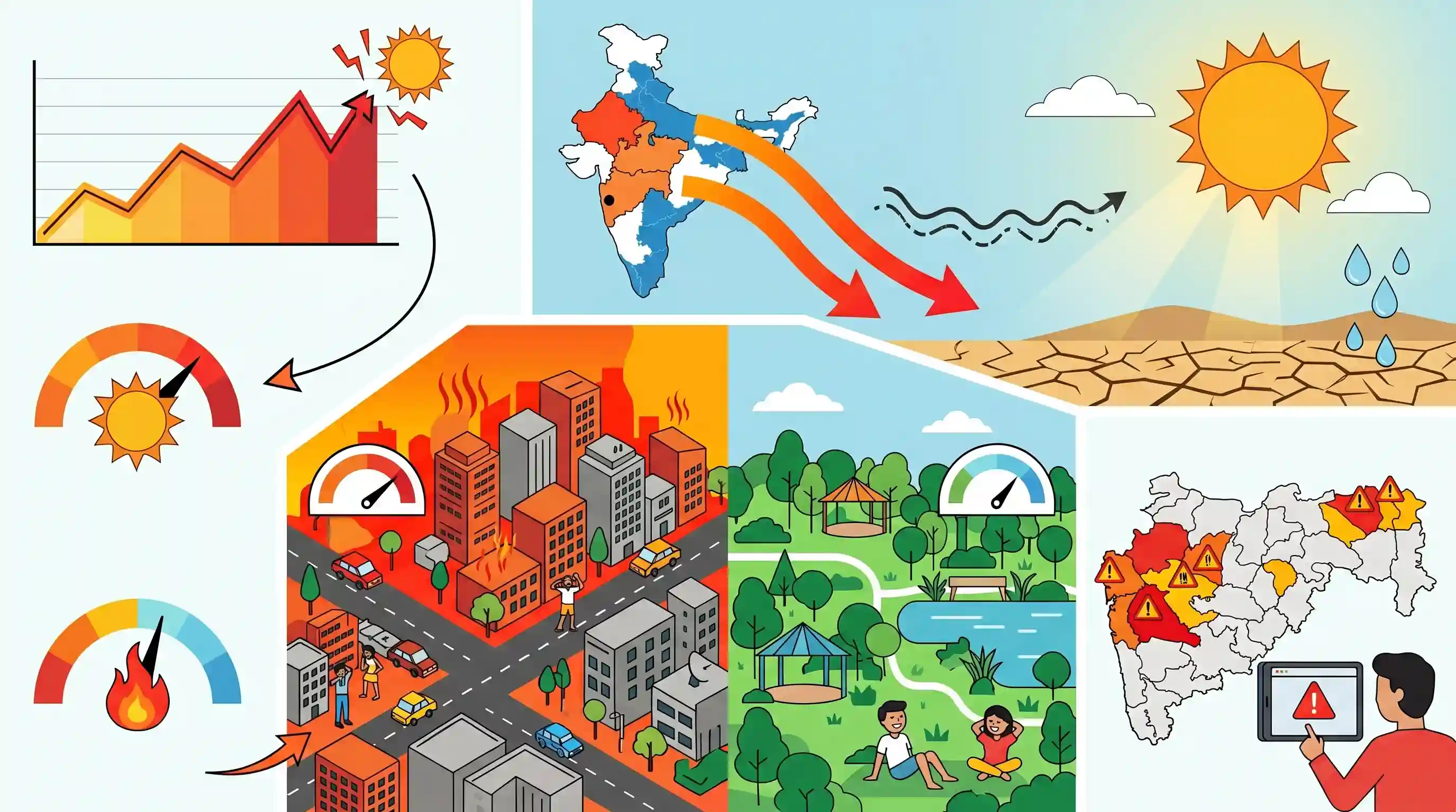
Pune experienced record-breaking high temperatures in May, with Lohegaon hitting 43.8°C and Shivajinagar recording 41.6°C, making it the city's hottest May day since at least 2015. The India Meteorological Department (IMD) attributed the extreme heat to the weakening of a local trough, which allowed hot northerly winds from Rajasthan and Madhya Pradesh to sweep into the region. Additional factors include clear skies permitting direct solar radiation and low atmospheric moisture. The city also displayed stark urban microclimate differences, with heavily developed neighborhoods sweltering above 40°C while greener areas like Pashan remained significantly cooler. Heatwave alerts were subsequently issued for broader regions of Maharashtra.
Key Points
- Pune recorded its hottest May day in over a decade, with temperatures reaching 43.8°C at Lohegaon and 41.6°C at Shivajinagar.
- The India Meteorological Department (IMD) announced heatwave alerts for Madhya Maharashtra, Marathwada, and Vidarbha, with Akola reaching 45.1°C.
- The extreme heat is attributed to hot northerly winds blowing from Rajasthan and Madhya Pradesh after a regional trough weakened and moved away.
- Clear skies allowing direct solar radiation and a lack of moisture from the Arabian Sea and Bay of Bengal exacerbated the heating.
- Significant microclimate variations were observed within Pune; built-up areas like Wadgaonsheri and Hadapsar exceeded 40°C, while Pashan remained relatively cooler at 30°C.
Important Terms
Heatwave

A period of abnormally high temperatures (≥40°C in plains, ≥30°C in hills) with a departure of 4.5°C–6.4°C from normal for two consecutive days.
UPSC context
GS1 (Climatology) and GS3 (Disaster Management); tests knowledge of extreme weather criteria and mitigation strategies.
Urban Heat Island (UHI)
A phenomenon where urban areas experience significantly higher temperatures than rural surroundings due to heat-trapping materials like concrete and lack of vegetation.
UPSC context
GS1 (Urbanization) and GS3 (Environment); relevant for urban planning and climate change adaptation.
India Meteorological Department (IMD)
The nodal agency under the Ministry of Earth Sciences responsible for meteorological observations, weather forecasting, and early warnings for natural disasters.
UPSC context
GS3 (Science & Tech; Disaster Management); essential for understanding India's institutional framework for weather and disaster monitoring.
Trough (Meteorology)
An elongated region of relatively low atmospheric pressure, typically associated with rising air and unsettled weather, whose movement influences local temperature shifts.
UPSC context
GS1 (Physical Geography); tests understanding of atmospheric pressure systems and their impact on regional climates.
Microclimate
Local atmospheric conditions that differ from the surrounding area, often created by specific urban density, topography, or vegetation levels.
UPSC context
GS1 (Geography) and GS3 (Environment); examines the localized impact of human activity and geography on climate.
Prelims Trap
A heatwave in the plains is declared whenever the maximum temperature crosses 40°C.
Crossing 40°C is only the base threshold. It must ALSO be accompanied by a temperature departure of at least 4.5°C from the normal, unless the actual temperature is ≥ 45°C.
Static Concepts Connected
What are the IMD's temperature thresholds for declaring a heatwave?
- Base Thresholds: The maximum temperature must reach at least 40°C for plains, 37°C for coastal areas, and 30°C for hilly regions.
- Normal Departure: The temperature must be 4.5°C to 6.4°C above the normal for that region. A departure of >6.4°C indicates a severe heatwave.
- Absolute Criteria: If the actual maximum temperature hits 45°C or more, a heatwave is declared irrespective of the normal temperature.
What primarily causes the Urban Heat Island (UHI) effect?
- Thermal Mass: Concrete, asphalt, and bricks absorb and retain significantly more solar radiation than natural ground cover.
- Lower Evapotranspiration: A lack of trees and water bodies reduces natural cooling, which normally occurs via moisture release from plants.
- Urban Geometry: Tall, densely packed buildings create urban canyons that block wind flow and trap outgoing longwave radiation.
Cross-Topic Patterns
Urban Heat Islands + Sponge Cities
The sharp contrast between Pune's concrete areas (40°C+) and green zones (30°C) highlights the need for 'Sponge City' infrastructure, emphasizing urban forestry and wetlands for thermal regulation.
Advection Winds + Pre-Monsoon Troughs
Advection of hot dry winds from Rajasthan into Maharashtra shows how the absence of localized pre-monsoon low-pressure troughs allows north-western heat to penetrate deep into peninsular India.

Urban Heat Island microclimate variations combined with IMD heatwave criteria (plains vs coastal thresholds) is a prime 2-statement Prelims Q.
Linked PYQs · 3
Linked PYQs · 3
- 2013MainsGS1
Bring out the causes for the formation of heat islands in the urban habitat of the world.
- 2022MainsGS1
Examine the potential of wind energy in India and explain the reasons for their limited spatial spread.
- 2013MainsGS1
Major hot deserts in northern hemisphere are located between 20-30 deg N latitudes and on the western side of the continents. Why?
