Annual Pilgrimage Highlights Security and Crowd Management Measures
Source:The Hindu ↗
Why It Matters
Highlights the intersection of geography (Himalayan passes and routes), internal security (CAPF deployment in conflict-prone areas), and technology (RFID applications for crowd management).
Summary
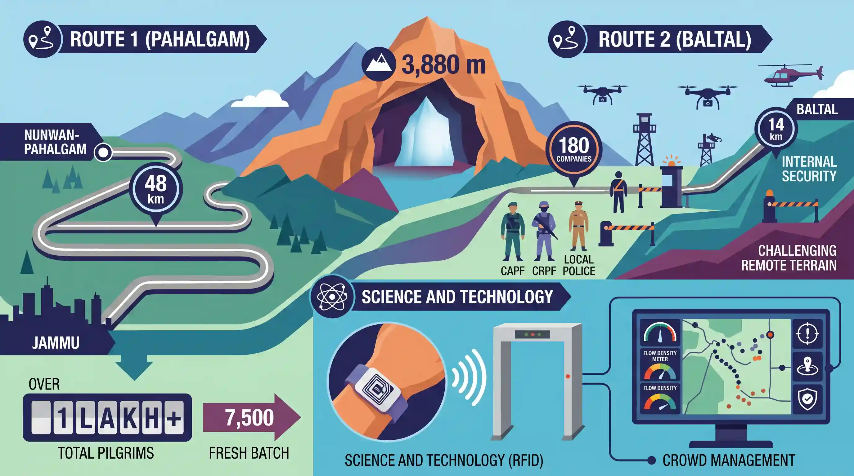
The annual Amarnath Yatra has commenced in Jammu and Kashmir, with a fresh batch of 7,500 pilgrims leaving Jammu for the 3,880-metre-high cave shrine in the south Kashmir Himalayas. The 38-day pilgrimage utilizes twin routes—the 48-km Nunwan-Pahalgam track in Anantnag and the 14-km Baltal track in Ganderbal. Due to internal security concerns and the challenging remote terrain, robust security measures are in place, including the deployment of 180 CAPF companies, CRPF, and local police. To further enhance safety and crowd management, pilgrims are being tracked using Radio Frequency Identification (RFID) tags. So far, the total number of pilgrims to visit the shrine this year has crossed one lakh.
Key Points
- The 38-day Amarnath Yatra is underway with over 1 lakh pilgrims having completed the visit to the 3,880-metre-high cave shrine in the south Kashmir Himalayas.
- Pilgrims use two main routes: the traditional 48-km Nunwan-Pahalgam route (Anantnag district) and the shorter, steeper 14-km Baltal route (Ganderbal district).
- Extensive security arrangements include the deployment of 180 Central Armed Police Force (CAPF) companies, alongside CRPF and J&K Police personnel.
- For efficient tracking and security, the administration has issued mandatory Radio Frequency Identification (RFID) tags to all pilgrims.
- Online registration has seen over 3.5 lakh applicants for the yatra in 2025.
Important Terms
Amarnath Yatra

Annual Hindu pilgrimage to a cave shrine in Jammu and Kashmir, dedicated to Lord Shiva, featuring a naturally formed ice stalagmite.
UPSC context
GS Paper I (Art & Culture/Geography); tests knowledge of pilgrimage sites and Himalayan topography.
RFID (Radio Frequency Identification)
Wireless technology using radio waves to identify and track tags on objects or people without requiring a direct line-of-sight.
UPSC context
GS Paper III (Science & Technology); tests applications of technology in security and governance.
Central Armed Police Forces (CAPF)
Collective name for seven security organizations under the Ministry of Home Affairs, responsible for internal security and border management.
UPSC context
GS Paper III (Security Forces and their Mandate); fundamental for internal security topics.
Central Reserve Police Force (CRPF)
India’s largest CAPF, primarily responsible for maintaining internal security, law and order, and conducting counter-insurgency operations.
UPSC context
GS Paper III (Internal Security); tests specific roles of security forces in conflict zones.
Crowd Management
The systematic planning and monitoring of large groups to ensure safety and prevent disasters like stampedes.
UPSC context
GS Paper III (Disaster Management); tests administrative response and NDMA safety guidelines.
Prelims Trap
"RFID tags provided to pilgrims actively transmit real-time GPS coordinates to satellites for tracking."
RFID relies on local electromagnetic fields and proximity readers. It does not actively transmit coordinates to satellites like GPS does.
Static Concepts Connected
How does Radio Frequency Identification (RFID) technology operate?
- Electromagnetic Fields: Uses short-range radio waves to read and capture information stored on a microchip attached to an object or person.
- Passive Tags: Do not possess a local power source; they are powered entirely by the electromagnetic energy transmitted from the RFID reader.
- Active Tags: Contain their own battery and can transmit signals over significantly greater distances than passive tags (e.g., FASTag on highways).
What are the key geographical features of the Amarnath Yatra routes?
- Lidder Valley: The traditional 48-km Pahalgam route passes through the Lidder River valley. The Lidder is a major tributary of the Jhelum River.
- Sind River: The shorter, steeper 14-km Baltal route runs near the Sind River, which is also a significant tributary of the Jhelum (distinct from the Indus/Sindhu).
- Greater Himalayas: The shrine is situated at 3,880 metres in the Greater Himalayan Range, an area vulnerable to localized weather events like cloudbursts.
Cross-Topic Patterns
NDMA & Tech-driven Crowd Management
Using RFID for pilgrims directly links to NDMA’s mass-gathering guidelines, a frequent Mains GS3 disaster management theme alongside Kumbh Mela preparations.
Geography of Kashmir's River Valleys
UPSC frequently tests the mapping of mountain passes and prominent pilgrim shrines to their local river valleys (e.g., the Lidder and Sind rivers in Kashmir).

Expect a Prelims S&T question distinguishing between RFID, NFC, and Bluetooth, focusing on active vs passive tags.
Linked PYQs · 4
Linked PYQs · 4
- 2023MainsGS3
Winning of 'Hearts and Minds' in terrorism-affected areas is an essential step in restoring the trust of the population. Discuss the measures adopted by the Government in this respect as part of the conflict resolution in Jammu and Kashmir.
- 2022PrelimsGS1
Consider the following pairs: Peak Mountains 1. Namcha Barwa: Garhwal Himalaya 2. Nanda Devi: Kumaon Himalaya 3. Nokrek: Sikkim Himalaya Which of the pairs given above is/are correctly matched?
- 2022PrelimsGS1
Consider the following communication technologies: 1. Closed-circuit Television 2. Radio Frequency Identification 3. Wireless Local Area Network Which of the above are considered Short-Range devices/technologies?
- 2025PrelimsGS1
Consider the following statements : I. Indian Railways have prepared a National Rail Plan (NRP) to create a 'future ready' railway system by 2028. II. 'Kavach' is an Automatic Train Protection system developed in collaboration with Germany. III. 'Kavach' system consists of RFID tags fitted on track in station section. Which of the statements given above are not correct?
