Ahmedabad Uses Ground Penetration Radar to Map Underground Utilities
Source:Indian Express ↗
Why It Matters
It demonstrates a practical application of physics and remote sensing technologies (GPR) in solving everyday administrative challenges, which is a frequent theme in UPSC S&T questions. It also serves as a strong case study for GS-2 (Governance) and GS-3 (Infrastructure/Smart Cities) on how tech-driven data can improve urban planning and mitigate disaster risks like urban flooding caused by damaged drainage.
Summary
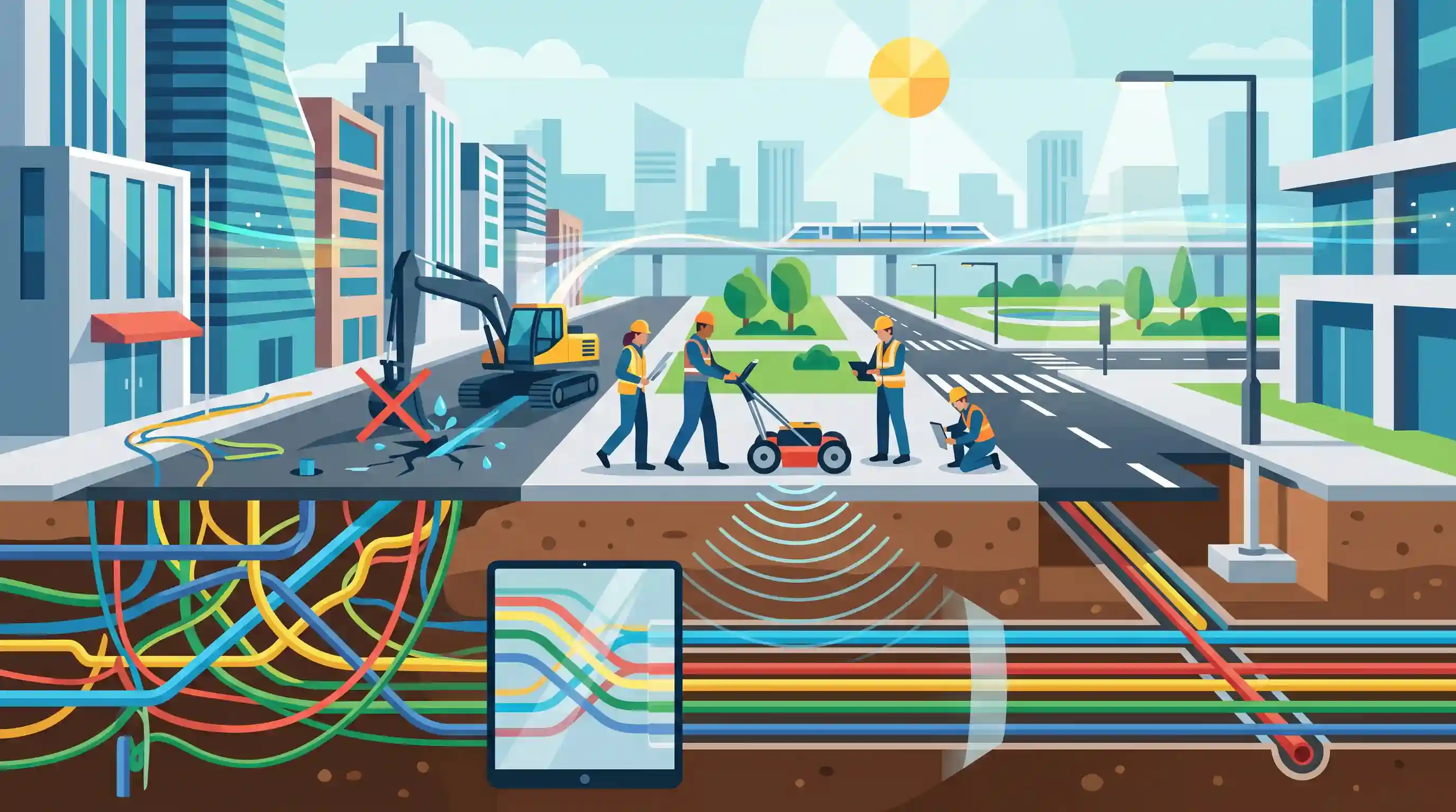
The Ahmedabad Municipal Corporation (AMC) has adopted Ground Penetrating Radar (GPR) technology to accurately map underground utilities across the city. As urban areas grow denser, executing new infrastructure projects often risks damaging existing subsurface pipelines and cables, leading to service outages and project delays. GPR provides a non-destructive method using electromagnetic radiation to visualize subsurface structures. By creating a comprehensive map of water, sewage, power, telecom, and gas lines, AMC aims to improve urban planning and ensure smoother execution of future infrastructure projects. This highlights the growing integration of advanced technologies in urban governance and city planning.
Key Points
- Ahmedabad Municipal Corporation (AMC) is utilizing Ground Penetrating Radar (GPR) technology to map subsurface utilities.
- The technology aims to detect and map underground infrastructure such as water pipelines, sewage systems, gas lines, and electrical cables.
- GPR is a non-destructive remote sensing method that uses high-frequency radio waves to image the subsurface without drilling or trenching.
- This mapping initiative is being carried out ahead of new infrastructure projects to prevent accidental damage to existing utilities during excavation.
- Accurate mapping prevents disruption of essential services, mitigates project delays, and reduces the risk of cost overruns in urban development.
Important Terms
Ground Penetrating Radar (GPR)

A geophysical imaging technology using electromagnetic pulses to visualize subsurface structures like pipes and cables without excavation. It works for both metallic and non-metallic materials.
UPSC context
GS Paper 3 (Science & Tech). Tests application of advanced sensors in urban planning and infrastructure safety.
Smart Cities Mission (SCM)
A 2015 central initiative by the Ministry of Housing and Urban Affairs to improve urban liveability and economic growth through technology-driven "smart solutions."
UPSC context
GS Paper 1 (Urbanization) & GS Paper 3 (Infrastructure). Tests knowledge of flagship schemes for sustainable urban development.
Integrated Command and Control Centre (ICCC)
The centralized "nerve center" of a smart city that monitors and coordinates utility management, traffic, and emergency response in real-time using data feeds.
UPSC context
GS Paper 2 (Governance). Essential for discussing digital governance and the implementation of "Smart Solutions."
Ahmedabad Municipal Corporation (AMC)
The Urban Local Body responsible for Ahmedabad's civic infrastructure; it is a pioneer in adopting separate climate budgets and technology-driven project management.
UPSC context
GS Paper 2 (Urban Local Bodies/74th Amendment). Case study for effective local governance and tech-adoption.
Non-Destructive Testing (NDT)
Inspection methods used to evaluate materials or subsurface features without causing physical damage or permanent changes to the structure being tested.
UPSC context
GS Paper 3 (S&T/Infrastructure). Awareness of modern engineering techniques that reduce infrastructure costs and service disruptions.
Urban Infrastructure
The basic physical systems of a city, including water, sewage, power, and transport lines, necessary for economic activity and public health.
UPSC context
GS Paper 3 (Infrastructure). Core topic regarding capital expenditure and managing challenges of dense urbanization.
Prelims Trap
Ground Penetrating Radar (GPR) relies on the reflection of high-frequency acoustic waves to map subsurface structures.
GPR uses electromagnetic radiation (radio waves and microwaves), not acoustic energy. Seismic or sonar surveys rely on sound/acoustic waves reflecting off mechanical boundaries.
Static Concepts Connected
What is the scientific principle behind Ground Penetrating Radar (GPR)?
- Electromagnetic waves: GPR utilizes high-frequency radio waves or microwaves (typically between 10 MHz to 3 GHz) to penetrate and image the subsurface.
- Dielectric permittivity: It detects buried objects by recording energy reflected from boundaries where subsurface electrical properties (dielectric permittivity) change, unlike seismic surveys.
- Non-destructive testing: It functions as a non-destructive remote sensing method, meaning no excavation or trenching is required to map utilities.
What is the 'Call Before u Dig' (CBuD) initiative?
- Nodal agency: A mobile app developed by the Department of Telecommunications (DoT) and BISAG-N to facilitate coordination between excavators and utility owners.
- Asset protection: Aims to prevent uncoordinated digging that damages underground utility assets like optical fibre cables, preventing an estimated ₹3,000 crore annual loss.
Cross-Topic Patterns
S&T applications in ASI excavations
GPR is increasingly used in forensic archaeology for non-intrusive imaging, recently helping unearth a 2,000-year-old Buddhist stupa in Haryana, linking modern tech applications directly to ancient history.
Tech-driven urban flood mitigation
Mapping subterranean drainage networks via GPR identifies unseen blockages and structural voids, providing a proactive disaster management tool against climate-induced urban flooding.

Expect a Prelims tech-application question pairing GPR, LiDAR, and Sonar with their underlying wave types (Electromagnetic vs Acoustic).
Linked PYQs · 3
Linked PYQs · 3
- 2024PrelimsGS1
Consider the following activities : 1. Identification of narcotics on passengers at airports or in aircraft 2. Monitoring of precipitation 3. Tracking the migration of animals In how many of the above activities can the radars be used?
- 2016MainsGS3
What are 'Smart Cities'? Examine their relevance for urban development in India. Will it increase rural-urban differences? Give arguments for 'Smart Villages' in the light of PURA and RURBAN Mission.
- 2024MainsGS3
Flooding in urban areas is an emerging climate-induced disaster. Discuss the causes of this disaster. Mention the features of two such major floods in the last two decades in India. Describe the policies and frameworks in India that aim at tackling such floods.
