ISRO sets GISAT 1A launch to end operational hiatus
Source:Indian Express ↗
কেন এটি গুরুত্বপূর্ণ
Crucial for understanding ISRO's launch vehicle reliability, recovery from operational setbacks, and the strategic deployment of earth observation payloads for national development and security.
সারসংক্ষেপ
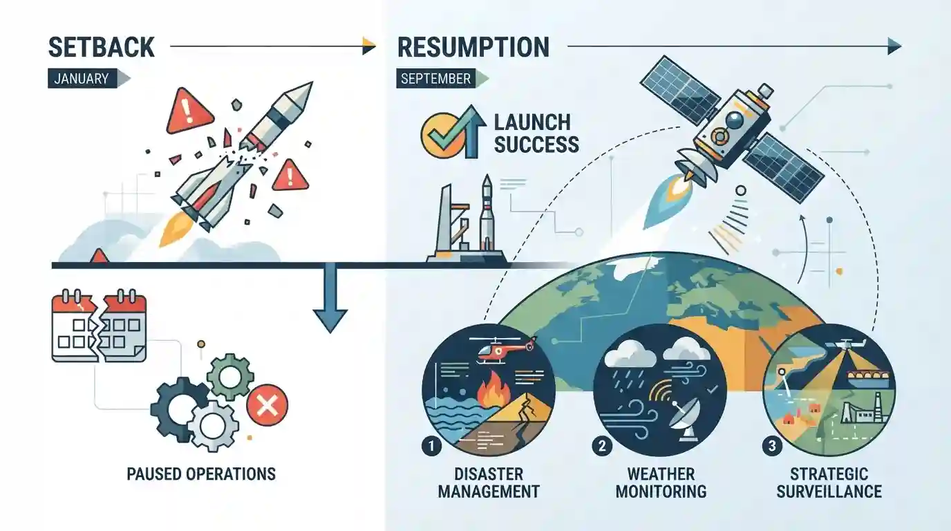
ISRO is preparing to launch the GISAT-1A Earth observation satellite in September, marking the end of a seven-month operational hiatus triggered by a launch vehicle setback in January. The satellite will provide critical real-time geo-imaging data for applications such as disaster management, weather monitoring, and strategic surveillance.
মূল বিষয়
- ISRO is set to launch the GISAT-1A satellite in September, ending a seven-month operational hiatus following a launch vehicle setback in January.
- GISAT-1A (Geo Imaging Satellite) is designed for continuous real-time observation of the Indian subcontinent at quick intervals, aiding in disaster management, agriculture, and strategic monitoring.
- The upcoming mission marks a crucial revival for ISRO's operational launch cadence and technological readiness after the anomaly earlier in the year.
গুরুত্বপূর্ণ শব্দ
ISRO

India's national space agency responsible for space research, satellite development, and launch operations, aiming to harness space technology for national development.
UPSC context
GS Paper III (Science & Tech): Essential for questions on achievements of Indians in science & technology, space missions, and policy.
GISAT-1A
An Earth observation satellite positioned in geosynchronous orbit to provide continuous, real-time geo-imaging data over the Indian subcontinent for disaster management and surveillance.
UPSC context
GS Paper III (Science & Tech): Tests awareness of recent satellite missions, remote sensing applications, and strategic space infrastructure.
Geosynchronous Orbit
An orbit with a period equal to Earth's rotational period, allowing a satellite placed in it to remain continuously fixed over the same region.
UPSC context
GS Paper III (Space Technology): Tests foundational concepts of satellite orbits, geostationary applications, and orbital mechanics.
সংযুক্ত স্থির ধারণা
What is the fundamental difference between Low Earth Orbit (LEO) and Geostationary Orbit (GEO) satellites used for Earth Observation?
- Altitude & Coverage: LEO Altitudes: LEO satellites operate at altitudes between 160 km and 2,000 km, providing high-resolution imagery but limited coverage duration over a single point.
- Continuous Imaging: GEO Surveillance: GEO satellites operate at 35,786 km matching Earth's rotation, enabling continuous, real-time monitoring of a fixed region like the Indian subcontinent.
- Revisit Rate: Revisit Frequency: GEO imaging payloads can capture data every few minutes for dynamic weather tracking, whereas LEO satellites revisit the same spot every few days.
আন্তঃবিষয় প্যাটার্ন
GISAT Geostationary Imaging + National Border Surveillance
High-altitude geostationary earth observation directly intersects with national security, border surveillance, and maritime domain awareness under the Indo-Pacific construct.
Launch Cadence Hiatus + Commercial Space Economy
ISRO launch vehicle setbacks impact commercial satellite export markets and NewSpace India Limited (NSIL) global launch commitments.

Expect a statement-based prelims question distinguishing between Low Earth Orbit (LEO) remote sensing satellites and Geostationary Earth Observation.
সংযুক্ত PYQ · 3
সংযুক্ত PYQ · 3
- 2016MainsGS3
Discuss India's achievements in the field of Space Science and Technology. How the application of this technology has helped India in its socio-economic development?
- 2023MainsGS3
What is the main task of India's third moon mission which could not be achieved in its earlier mission? List the countries that have achieved this task. Introduce the subsystems in the spacecraft launched and explain the role of the Virtual Launch Control Centre' at the Vikram Sarabhai Space Centre which contributed to the successful launch from Sriharikota.
- 2019PrelimsGS1
For the measurement/estimation of which of the following are satellite images/remote sensing data used? 1. Chlorophyll content in the vegetation of a specific location 2. Greenhouse gas emissions from rice paddies of a specific location 3. Land surface temperatures of a specific location Select the correct answer using the code given below.
