Monsoon Fatalities and Road Blockages Rise Across Himachal Pradesh
Source:tribune-india ↗
Why It Matters
The article underscores the practical implications of Himachal Pradesh's climate and topography during the monsoon season. For HPAS Prelims, understanding rainfall distribution, climatic zones, and the vulnerability of specific districts (like Kangra, Mandi, Sirmaur) to natural disasters is highly relevant, as reflected in previous year questions on HP geography.
Summary
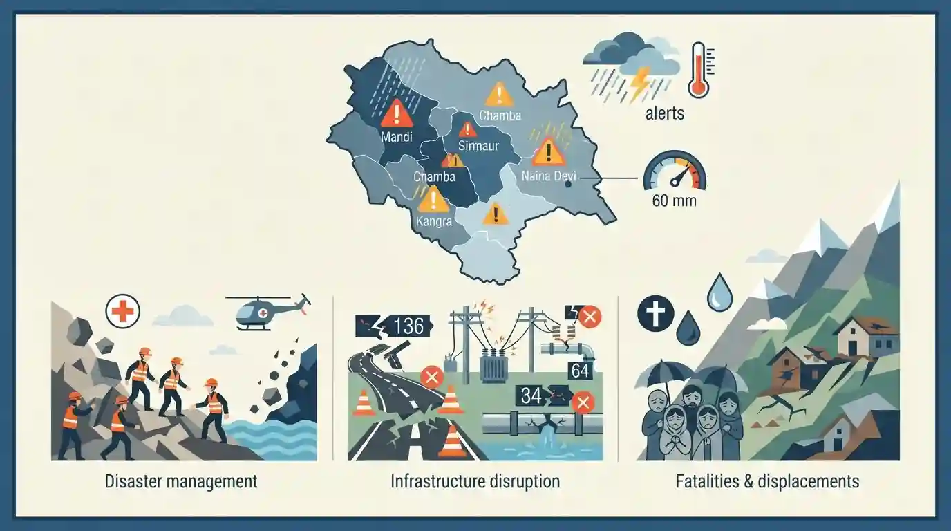
The ongoing monsoon season in Himachal Pradesh has resulted in 75 fatalities and widespread disruption of essential infrastructure. Revenue Minister Jagat Singh Negi reported that 136 roads, 375 water supply schemes, and 64 electricity transformers are currently blocked or non-functional. Districts such as Mandi, Sirmaur, Shimla, Chamba, and Kangra have been severely affected. The local meteorological office has issued orange and yellow alerts, warning of further heavy rains, flash floods, and landslides in several districts until late July. Naina Devi recorded the maximum rainfall at 60 mm. The situation highlights the vulnerability of the state's geography to extreme monsoon weather patterns.
Key Points
- 75 individuals have died in Himachal Pradesh during the current monsoon season.
- As per Revenue Minister Jagat Singh Negi, 136 roads, 375 water supply schemes, and 64 transformers remain disrupted.
- Mandi, Sirmaur, Shimla, and Chamba are among the worst-hit districts in terms of blocked roads and disrupted services.
- An 'orange alert' for heavy showers has been issued, alongside warnings for flash floods and landslides in multiple districts including Solan, Sirmaur, Shimla, and Kangra.
- Naina Devi in Bilaspur district recorded the highest rainfall of 60 mm.
Important Terms
State Emergency Operation Centre (SEOC)

A state-level nodal disaster management hub under the State Disaster Management Authority. It coordinates emergency response, resource allocation, early warnings, and inter-departmental communication during natural or man-made calamities.
UPSC context
GS Paper 3 (Disaster Management). Essential for understanding the institutional framework and coordination in disaster response.
India Meteorological Department (IMD)
The principal government agency under the Ministry of Earth Sciences responsible for meteorological observations, weather forecasting, seismology, and issuing early warnings for severe natural hazards like cyclones and heavy rainfall.
UPSC context
GS Paper 1 & 3 (Geography & Disaster Management). Vital for topics on monsoon forecasting, climate alerts, and early warning systems.
Colour-Coded Weather Alerts
An IMD early warning system indicating weather severity. 'Yellow' (Be Aware) signals potential worsening conditions, while 'Orange' (Be Prepared) warns of extreme weather that can disrupt commute, power, and daily life.
UPSC context
GS Paper 3 (Disaster Management). Relevant for evaluating disaster preparedness, public safety protocols, and early warning mechanisms.
Flash Floods
A rapid, extreme flow of high water into normally dry areas, usually occurring within six hours of intense rainfall, cloudbursts, or dam failures. They are highly destructive due to their sudden onset.
UPSC context
GS Paper 1 & 3. Tests knowledge on Himalayan ecosystem vulnerabilities, urban flooding, and climate change impacts.
Landslides
The downward movement of rock, soil, and debris along a slope under gravity's influence. In fragile terrains, they are frequently triggered by intense monsoon rainfall, deforestation, and unplanned infrastructure construction.
UPSC context
GS Paper 1 & 3. Important for questions on mountain ecosystem degradation, hazard zonation, and sustainable hill development.
Prelims Trap
"IMD's 'Orange Alert' implies 'Take Action' and mandates immediate evacuation by local authorities."
Orange means 'Be Prepared' for disruptions. It is the 'Red Alert' that implies 'Take Action'. UPSC often swaps these color-code definitions.
Static Concepts Connected
Why are the Himalayas more prone to landslides than the Western Ghats?
- Geological Age: Himalayas are young fold mountains with highly fragile, unconsolidated sedimentary rocks, whereas Western Ghats are a stable geological shield.
- Tectonic Instability: The Himalayan region is seismically active due to the ongoing Indo-Australian and Eurasian plate collision, weakening rock structures.
- Slope Gradient: Himalayas feature significantly steeper topographic gradients, accelerating rapid mass wasting during heavy orographic monsoon rainfall.
What are the core NDMA guidelines for Landslide Risk Management?
- Hazard Zonation: Mandates macro and micro-level Landslide Hazard Zonation (LHZ) mapping to strictly regulate or restrict construction in vulnerable hilly terrains.
- Early Warning Systems: Focuses on integrating site-specific rainfall thresholds with surface monitoring to trigger timely localized community alerts and evacuations.
- Mitigation Measures: Promotes retaining walls, bio-engineering (planting deep-rooted vegetation), and proper surface drainage to stabilize slopes.
Cross-Topic Patterns
Himalayan Infra vs. Ecology
Relentless road widening and hydropower projects in HP and Uttarakhand frequently violate carrying capacity, turning geological hazards into anthropogenic disasters.
Climate Change & Cloudbursts
Warming oceans alter monsoon wind moisture capacity, escalating the frequency of intense localized orographic precipitation (cloudbursts) in the Himalayan region.

Expect a GS3 Mains question evaluating the enforcement of NDMA’s Landslide Hazard Zonation maps amidst Himalayan infrastructure pushes.
Linked PYQs · 2
Linked PYQs · 2
- 2024HPAS_PRELIMSGS1
Arrange the following climatic zones of Himachal Pradesh according to rainfall amount from lowest to highest : (1) Frigid aridic zone (2) Wet temperate zone (3) Humid sub-tropical zone (4) Sub-humid sub-tropical zone Choose the correct answer from the options given below :
- 2023HPAS_PRELIMSGS1
Consider the following statements : (1) The rainiest district in Himachal Pradesh is Kangra. (2) Rainfall in the Alpine region of Himachal Pradesh varies between 300-600 mm. (3) Winter season in Himachal Pradesh extends from October to March. (4) Mandi is the hottest place in Himachal Pradesh. Choose the correct answer from the options given below :
