Rameswaram Fishermen Protests Loom as Annual Fishing Ban Ends
Source:The Hindu ↗
Why It Matters
The frequent arrest of Indian fishermen and disputes over Katchatheevu in the Palk Bay remain a major irritant in India-Sri Lanka bilateral ties. The issue perfectly bridges GS2 (International Relations/border disputes) and GS3 (Marine conservation policies like the annual fishing ban to prevent overfishing).
Summary
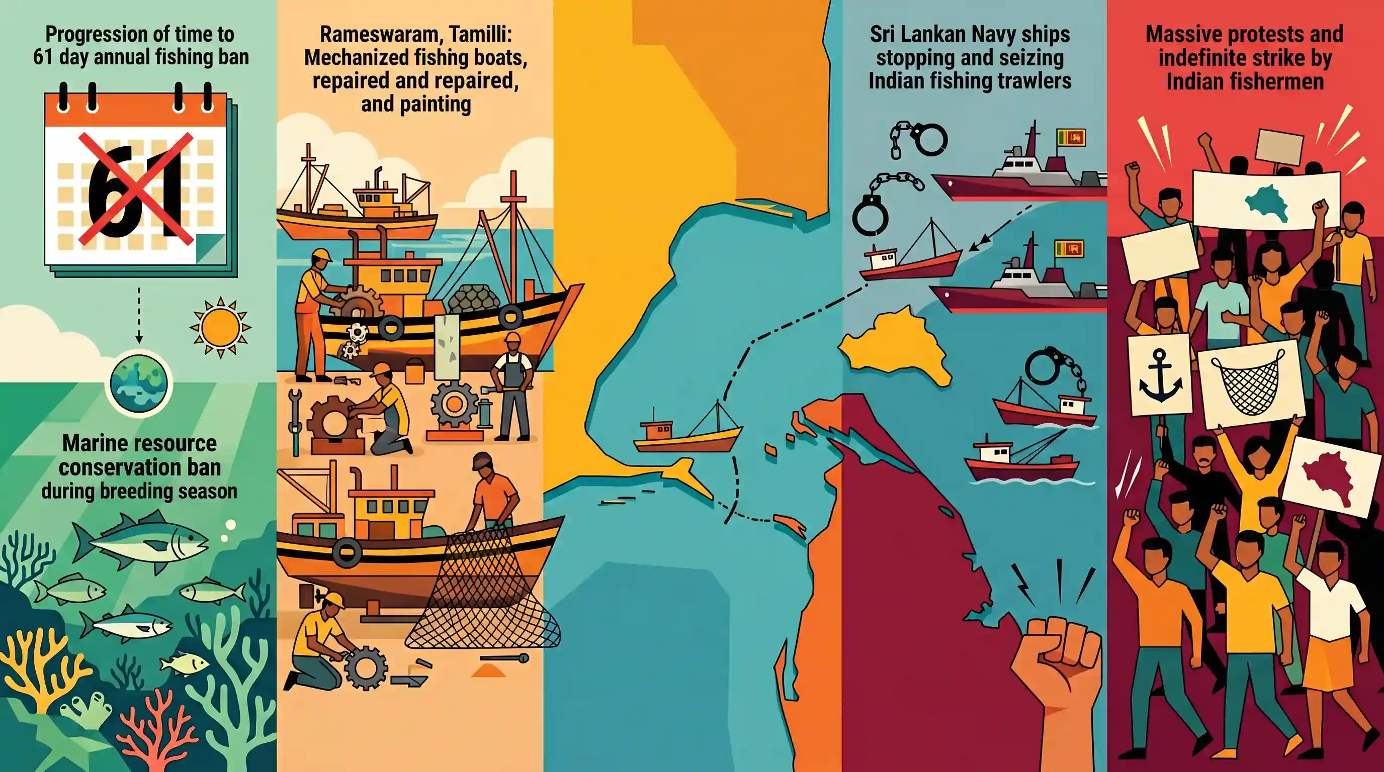
The 61-day annual fishing ban, enforced to protect marine ecology during the breeding season, is set to end in Rameswaram, Tamil Nadu. While mechanized boat operators are overhauling their vessels to resume deep-sea fishing, unresolved geopolitical grievances threaten to disrupt operations. The fishermen's associations have announced an indefinite strike and massive protests to press for the retrieval of the Katchatheevu island from Sri Lanka. This long-standing demand seeks to secure conflict-free traditional fishing rights in the Palk Bay and end the frequent arrests of Indian fishermen and seizure of boats by the Sri Lankan Navy.
Key Points
- The 61-day annual fishing ban along the Tamil Nadu coast, implemented to conserve marine resources during the breeding season, is ending.
- Fishermen incur high costs (up to ₹5 lakh per boat) to overhaul their mechanized vessels ahead of the new season.
- Fishermen associations in Rameswaram have planned a continuous strike and protests demanding the retrieval of Katchatheevu island from Sri Lanka.
- The fishermen are seeking a permanent solution to ensure conflict-free traditional fishing rights in the Palk Bay.
- There is an urgent demand for the release of 25 Indian fishermen and 132 mechanized boats currently detained by Sri Lankan authorities.
Important Terms
Katchatheevu Island

A 285-acre uninhabited island in the Palk Strait, ceded to Sri Lanka by India through bilateral agreements in the 1970s.
UPSC context
GS Paper 2: International Relations; a flashpoint in India-Sri Lanka ties and maritime boundary disputes.
India-Sri Lanka Maritime Boundary Agreements (1974/1976)
Two bilateral treaties (1974 and 1976) that delimited the maritime boundary in the Palk Strait, Palk Bay, Gulf of Mannar, and Bay of Bengal.
UPSC context
GS Paper 2: Bilateral agreements; defines sovereign rights over resources and the International Maritime Boundary Line.
International Maritime Boundary Line (IMBL)
The demarcation line between the maritime jurisdictions of India and Sri Lanka, which Indian fishermen are often accused of crossing.
UPSC context
GS Paper 3: Internal Security/Border Management; tests knowledge of maritime security and sovereignty issues.
Annual Fishing Ban
A mandatory 61-day seasonal halt (typically April 15–June 14) on mechanized fishing to allow fish species to spawn and replenish stocks.
UPSC context
GS Paper 3: Conservation; related to sustainable fisheries management and the Blue Economy.
Palk Strait
A narrow strip of water separating the state of Tamil Nadu from the Mannar district of Sri Lanka, serving as a shared fishing ground.
UPSC context
GS Paper 1: Geography; GS Paper 2: International Relations; critical for understanding local geopolitical and ecological dynamics.
Tamil Nadu Marine Fishing Regulation Act, 1983
State legislation that empowers the government to regulate fishing, including enforcing seasonal bans and prohibiting harmful practices like bottom trawling.
UPSC context
GS Paper 2: Governance/Statutory Acts; governs the legal framework for coastal management in Tamil Nadu.
Prelims Trap
Indian fishermen possess traditional fishing rights around Katchatheevu under the 1974 agreement.
The 1974 pact only allows Indian fishermen access to Katchatheevu for rest, drying nets, and the St. Anthony's festival. It explicitly does not grant fishing rights.
Static Concepts Connected
How is the maritime boundary delineated in the Palk Bay region?
- Historic Waters: Palk Bay is treated as historic waters, meaning the boundary was drawn using a modified equidistance principle rather than standard UNCLOS baseline rules.
- 1974/1976 Pacts: The 1974 pact delineated the boundary and ceded Katchatheevu to Sri Lanka. The 1976 agreement established overlapping EEZ limits in the Gulf of Mannar.
- Bottom Trawling Ban: Sri Lanka enacted stringent laws in 2017 banning destructive bottom trawling by Indian mechanized boats, leading to strict enforcement and vessel seizures.
What are the rules governing India's annual uniform fishing ban?
- Dual Timelines: The 61-day ban is implemented April-June for the East Coast and June-August for the West Coast to align with regional monsoon fish breeding seasons.
- Mechanized vs Traditional: The ban specifically restricts mechanized and motorized vessels from operating in the EEZ. Traditional, non-motorized artisanal fishermen are exempt.
- Ecological Rationale: It is enforced to protect marine ecology, allowing fish stocks to replenish and preventing the over-exploitation of vulnerable benthic habitats.
Cross-Topic Patterns
Trawling vs. Benthic Marine Ecology
The India-Sri Lanka geopolitical dispute is fundamentally ecological; Indian bottom trawlers destroy coral reefs and seagrass in Palk Bay, triggering Sri Lanka's 2017 ban on the practice.
Deep Sea Fishing Transition (PMMSY)
India leverages the PM Matsya Sampada Yojana to transition Palk Bay fishermen from destructive bottom trawling to deep-sea fishing, simultaneously protecting marine ecology and mitigating bilateral friction.

Expect a multi-statement Prelims question merging the 1974 Katchatheevu agreement specifics with UNCLOS historic waters and bottom trawling.
Linked PYQs · 3
Linked PYQs · 3
- 2025MainsGS3
Why is maritime security vital to protect India's sea trade? Discuss maritime and coastal security challenges and the way forward.
- 2022MainsGS2
India is an age-old friend of Sri Lanka.’ Discuss India's role in the recent crisis in Sri Lanka in the light of the preceding statement.
- 1996PrelimsGS1
The Palk Bay lies between
