Himachal Monsoon Disruption: Road Closures and Infrastructure Impact
Source:webindia123 ↗
Why It Matters
The article highlights the recurring vulnerability of Himachal Pradesh's mountainous terrain to monsoonal rains and landslides. Understanding the geographical distribution of affected districts and the socio-economic impact on infrastructure is essential for state-level disaster management and urban planning, themes which feature heavily in HPAS preliminary and mains examinations.
Summary
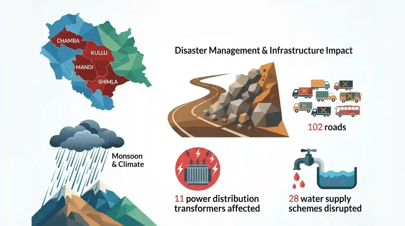
Heavy monsoon rainfall in Himachal Pradesh has led to widespread disruption, triggering landslides that blocked 102 roads, particularly in the Mandi, Kullu, Shimla, and Chamba districts. According to the State Emergency Operation Centre (SEOC), while national highways remain open, local infrastructure has taken a hit with 11 power distribution transformers and 28 water supply schemes adversely affected across the state.
Key Points
- Heavy monsoon rains have severely disrupted normal life in Himachal Pradesh, leading to widespread road closures and utility failures.
- According to the State Emergency Operation Centre (SEOC), 102 roads are closed, with Mandi district being the worst affected (43 roads blocked).
- Other severely impacted districts include Kullu, Shimla, Chamba, Sirmaur, and Una, though national highways remain open.
- Infrastructure damages include 11 power distribution transformers (DTRs) rendered out of service and 28 water supply schemes disrupted.
Important Terms
State Emergency Operation Centre (SEOC)

A 24/7 centralized command facility established under the Disaster Management Act, 2005, serving as the core hub for real-time monitoring, communication, and multi-agency response coordination during state-level emergencies.
UPSC context
GS Paper III (Disaster Management); tests knowledge of decentralized administrative frameworks and emergency response systems during natural disasters.
Disaster Management Act, 2005
A landmark Indian legislation that outlines the institutional framework for disaster management, creating the National, State, and District Disaster Management Authorities to transition from a relief-centric to a proactive mitigation approach.
UPSC context
GS Paper III (Disaster Management) & GS Paper II (Polity); tests understanding of statutory disaster frameworks, federal governance, and mitigation policies.
Southwest Monsoon
A seasonal wind system blowing from the southwest between June and September, responsible for delivering over 70-75% of India's annual rainfall and critically driving the country's agricultural economy.
UPSC context
GS Paper I (Physical Geography); tests understanding of Indian climate mechanisms, atmospheric dynamics, and geographic precipitation patterns.
Landslide Hazard Zonation (LHZ)
A mapping technique dividing land into homogeneous regions based on their susceptibility to slopes sliding under gravity, enabling decision-makers to regulate development in high-risk zones.
UPSC context
GS Paper III (Disaster Management); tests knowledge of geospatial technologies, risk assessment, and mitigation planning for geo-hazards.
Landslide Risk Mitigation Scheme (LRMS)
A proposed national scheme that provides financial assistance to landslide-prone states for site-specific mitigation, disaster prevention, early warning system R&D, and local capacity-building initiatives.
UPSC context
GS Paper III (Infrastructure & Disaster Management); tests understanding of fiscal schemes, technological interventions, and central-state financial cooperation for mitigation.
Prelims Trap
Western Disturbances are strictly winter phenomena and do not interact with the Southwest Monsoon.
Aspirants assume WDs only cause winter precipitation. However, their interaction with the advancing Southwest monsoon is the primary driver of catastrophic summer cloudbursts and flash floods in the Northwest Himalayas.
Static Concepts Connected
What is the institutional structure under the Disaster Management Act, 2005?
- Three-tier setup: Establishes disaster management authorities at the National (NDMA), State (SDMA), and District (DDMA) levels.
- Leadership roles: The Prime Minister chairs the NDMA, Chief Ministers head SDMAs, and District Magistrates/Collectors lead DDMAs.
- Statutory nature: Provides legislative backing for disaster mitigation, capacity-building, and disaster response funds across all levels.
What geological factors make the Himalayas exceptionally vulnerable to landslides?
- Fragile lithology: The Himalayas are young fold mountains composed of highly weathered, fractured, and unconsolidated rock strata.
- Seismic instability: Located near active fault lines like the Main Boundary Thrust, causing frequent tectonic shaking and slope destabilization.
- High relief: Steep slope angles combined with intense, concentrated monsoon rainfall trigger rapid downslope mass wasting.
Cross-Topic Patterns
Himalayan infrastructure vs. Eco-resilience
Linear infrastructure like highways and run-of-the-river hydro projects in fragile terrains accelerates slope instability, converting natural heavy rainfall into catastrophic landslide disasters.
Siltation risks to Himalayan hydro
Extreme cloudbursts and landslides trigger heavy siltation in rivers like the Beas and Sutlej, forcing sudden shutdowns of run-of-the-river power plants and disrupting regional grids.

Mains 2026 may ask to analyze how the collision of Western Disturbances and Southwest Monsoon impacts Himalayan infrastructure resilience.
Linked PYQs · 5
Linked PYQs · 5
- 2024HPAS_PRELIMSGS1
Arrange the following climatic zones of Himachal Pradesh according to rainfall amount from lowest to highest : (1) Frigid aridic zone (2) Wet temperate zone (3) Humid sub-tropical zone (4) Sub-humid sub-tropical zone Choose the correct answer from the options given below :
- 2010HPAS_PRELIMSGS1
In which District of Himachal Pradesh is Uhal Hydroelectric Project located ?
- 2024HPAS_PRELIMSGS1
Consider the following statements : (1) Monkey valley lies in Chamba. (2) Kiarda Dun valley lies in Kangra. (3) The Great Himalayas are referred as Alpine zone in Himachal Pradesh. (4) Churadhar pertain to Zanskar range in Himachal Pradesh Choose the correct answer from the options given below :
- 2025HPAS_PRELIMSGS1
Match List I with List II : | List-I (Wildlife Sanctuary) | List-II (District) | |---|---| | (a) Kias | (i) Kullu | | (b) Tarla | (ii) Shimla | | (c) Tundah | (iii) Chamba | | (d) Bandli | (iv) Mandi | Choose the correct answer from the options given below : Code: (a) (b) (c) (d)
- 2024HPAS_PRELIMSGS1
For the year 2022-23, match the Industry sub-sector in Himachal Pradesh with the percentage of workers employed in them : | List I (Industry Sub-sector) | List II (Percentage of workers employed) | |---|---| | (a) Mining and Quarrying | (i) 2 | | (b) Manufacturing | (ii) 41 | | (c) Electricity and Other Utilities | (iii) 50 | | (d) Construction | (iv) 7 | Choose the correct option : Code: (a) (b) (c) (d)
