अरावली पर्वतमाला का पुनर्वर्गीकरण पारिस्थितिक संरक्षण के लिए खतरा
स्रोत:द हिंदू ↗
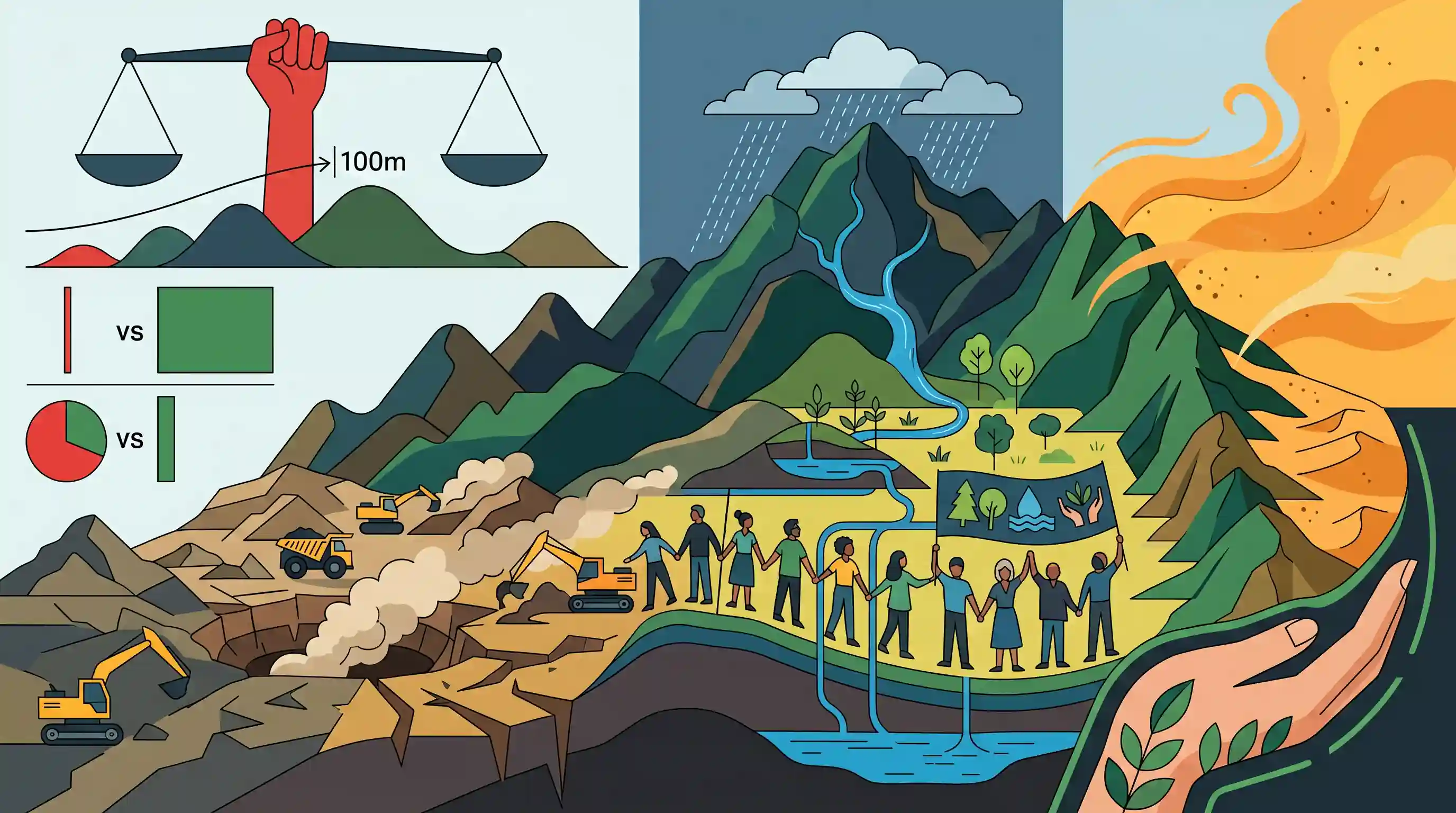
क्यों मायने रखता है
Demonstrates the conflict between rigid bureaucratic definitions (e.g., defining hills by height) and holistic ecological conservation, specifically highlighting the environmental hazards of mining and the crucial role of the Aravallis in preventing desertification in North-West India.
सारांश
A recent government reclassification establishing a 100-metre height threshold for the legal protection of hills has raised significant environmental concerns regarding the Aravalli Range. The conservation collective 'We Are Aravalli' warns that this metric strips 31.8% of the mountain range of legal safeguards, contradicting the Centre's estimate of a mere 0.19% impact. These vulnerable low-elevation zones are ecologically vital, functioning as critical water recharge areas, dust barriers, and a natural wall against the expansion of the Thar Desert. The group is urging the government to declare the entire Aravalli ecosystem a fully protected zone and enforce a complete ban on mining activities to preserve its ecological integrity.
मुख्य बिंदु
- केंद्र द्वारा हाल ही में किए गए एक वर्गीकरण में पहाड़ियों के कानूनी संरक्षण के लिए न्यूनतम ऊंचाई 100 मीटर निर्धारित की गई है।
- The conservation group 'We Are Aravalli' asserts that this threshold removes legal protection from 31.8% of the Aravalli range, contrasting the Centre's claim that only 0.19% would be affected.
- Low-elevation areas of the Aravallis serve critical ecological functions, acting as primary water recharge zones, effective dust barriers, and a crucial shield preventing the eastward expansion of the Thar Desert.
- The collective utilized satellite data and the Copernicus Digital Elevation Model (FABDEM) to analyze the impact of the reclassification.
- Environmentalists demand that the entire Aravalli range be declared a 'fully protected zone,' alongside a complete ban on mining and cancellation of existing mining leases.
महत्वपूर्ण शब्द
Aravalli Range

विश्व की सबसे पुरानी वलित पर्वत प्रणालियों में से एक, जो गुजरात से दिल्ली तक लगभग 692 किमी तक फैली हुई है। यह जलवायु नियामक और थार मरुस्थल के विरुद्ध एक अवरोध के रूप में कार्य करती है।
UPSC context
GS-I (Geography) & GS-III (Environment). Tests knowledge of mountain systems, ecological barriers, and land degradation neutrality.
Forest Conservation Amendment Act (2023)
Legislation narrowing the definition of protected 'forests' to lands recorded post-1980 and exempting strategic infrastructure (e.g., within 100km of borders) from environmental clearances.
UPSC context
GS-III (Environmental Legislation). Tests understanding of regulatory shifts in forest management and federal environmental governance.
100-metre height threshold
A recent legal criterion defining 'Aravalli hills' only as landforms rising 100m above local relief, potentially stripping lower, ecologically vital ridges of legal protection.
UPSC context
GS-III (Environment & Judiciary). Tests ability to analyze specific regulatory metrics and their cascading ecological impacts.
We Are Aravalli
A people-driven conservation collective in Jaipur/NCR that uses satellite data to advocate for the protection of the entire Aravalli ecosystem against mining and desertification.
UPSC context
GS-III (Environment). Example of civil society participation in environmental advocacy and its role in monitoring ecological threats.
Desertification
A type of land degradation in which relatively dry land becomes increasingly arid, typically losing its bodies of water as well as vegetation and wildlife.
UPSC context
GS-I (Geography) & GS-III (Disaster Management). Core topic for India’s commitments to UNCCD and land degradation neutrality.
Central Empowered Committee (CEC)
A Supreme Court-constituted body (2002) that monitors environmental compliance and advises the judiciary on matters concerning forest diversion, mining, and conservation.
UPSC context
GS-II (Polity/Judiciary). Tests knowledge of judicial interventions in environment and the role of specialized advisory committees.
प्रारंभिक ट्रैप
"Under the recent classification, only Aravalli hills exceeding 100 metres above mean sea level are granted legal protection."
The threshold relies on "local relief" (relative height from the surrounding terrain), not mean sea level. This relative metric excludes heavily eroded, low-elevation foothills from legal protection.
संबंधित अवधारणाएँ
अरावली श्रेणी का भौगोलिक और जलवायुवीय महत्व क्या है?
- Oldest Fold Mountains: They are relict mountains dating to the Precambrian era, heavily eroded over millions of years into low-elevation ridges.
- Monsoon Alignment: Aligned parallel to the advancing Arabian Sea branch of the South-West Monsoon, providing no orographic barrier and leading to Rajasthan's aridity.
- Desertification Shield: यह उपजाऊ भारत-गंगा के मैदानों में थार मरुस्थल के पूर्व की ओर विस्तार को रोकने के लिए एक महत्वपूर्ण भौतिक वायु-अवरोधक (windbreak) के रूप में कार्य करती है।
- जल विभाजक: Separates the drainage basin of the Bay of Bengal (via Banas/Chambal) from that of the Arabian Sea (via Luni/Sabarmati).
What are India's key initiatives to combat desertification?
- बॉन चैलेंज लक्ष्य: India aims to restore 26 million hectares of degraded and deforested land by 2030 under its UNCCD commitments.
- Great Green Wall: A proposed 1,400 km long and 5 km wide ecological corridor from Porbandar to Panipat along the Aravallis to halt desertification.
- Desertification Mapping: ISRO's Space Applications Centre actively maps degraded lands, currently estimating that nearly 30% of India's Total Geographical Area is undergoing degradation.
अंतर-विषय पैटर्न
FCA Amendments vs. Judicial Forest Definitions
The deregulation of low-elevation hills highlights conflicts between recent Forest Conservation Act exemptions and Supreme Court mandates protecting 'dictionary meaning' forests (T.N. Godavarman case) in ecologically sensitive zones.
Earth Observation Tech in Green Litigation
Civil society is increasingly using satellite data and ML tools like FABDEM to challenge state environmental impact assessments, reflecting a distinct shift towards data-driven environmental PILs at the NGT.

Expect a multi-statement prelims question linking Aravalli's erosional history (relict mountain), the 'local relief' metric, and desertification.
संबद्ध PYQ · 3
संबद्ध PYQ · 3
- 2020MainsGS1
The process of desertification does not have climatic boundaries. Justify with examples.
- 2019MainsGS1
How can the mountain ecosystem be restored from the negative impact of development initiatives and tourism?
- 2025MainsGS3
Mineral resources are fundamental to the country's economy and these are exploited by mining. Why is mining considered an environmental hazard? Explain the remedial measures required to reduce the environmental hazard due to mining.
