Uttarakhand expands aviation network to boost hill connectivity
Source:indiatimes ↗
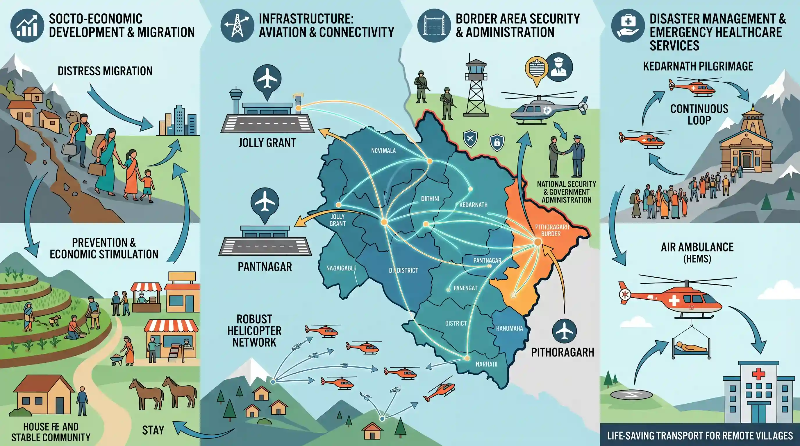
Why It Matters
Air connectivity in Himalayan states is not just a matter of convenience but is vital for strategic border defence, rapid disaster response/emergency healthcare, and mitigating the critical socio-economic problem of hill migration (ghost villages).
Summary
This article details how Uttarakhand is addressing its severe geographical and connectivity challenges by investing heavily in regional aviation infrastructure. The state's aviation strategy centers on three key airports—Jolly Grant, Pantnagar, and Pithoragarh—supplemented by a robust helicopter network. This network serves the twin purposes of easing pilgrimage tourism (such as flights to Kedarnath) and providing life-saving emergency medical transport through an air ambulance service for remote villages. Ultimately, the state government intends for these connectivity upgrades to stimulate local economies, support border security, and prevent distress migration from the hill districts.
Key Points
- Uttarakhand is strengthening its regional aviation network through three key operational airports: Jolly Grant in Dehradun, Pantnagar in the Kumaon foothills (Udham Singh Nagar), and Pithoragarh Airport (Naini Saini) in the border district.
- Pithoragarh Airport has high strategic value because the district shares borders with China and Nepal; the airport supports defence requirements, state administration, and local tourism.
- The state's helicopter initiative serves a dual role: enhancing religious tourism (such as flights to Kedarnath) and acting as a life-saving public service by providing rapid air ambulance assistance to remote villages (with a response time of around 22 minutes).
- The broader socio-economic objective of these investments is to boost local business and farming while curbing migration (palayan) from high-altitude hill areas by keeping remote communities economically viable.
Important Terms
Regional Connectivity Scheme (RCS-UDAN)

A central government initiative launched in 2016 under the National Civil Aviation Policy to make air travel affordable by developing regional airports and subsidizing flights on unserved and underserved routes.
UPSC context
GS Paper III: Infrastructure (Aviation) and Economic Growth; tests understanding of public-private partnerships, viability gap funding, and regional equity.
Helicopter Emergency Medical Service (HEMS)
A specialized emergency aviation initiative, such as Project Sanjeevani in Uttarakhand, designed to provide rapid medical transport and treatment to critically ill patients and trauma victims in remote areas.
UPSC context
GS Paper II & III: Health Governance and Disaster Management; evaluates crisis response and healthcare access in hard-to-reach or mountainous regions.
Helicopter Connectivity Programme
An infrastructure initiative under the UDAN scheme designed to link remote mountain villages, border outposts, and pilgrimage destinations via helipads to support tourism, local development, and security.
UPSC context
GS Paper III: Infrastructure and Regional Connectivity; tests policies aimed at mitigating geographical isolation and preventing distress migration in hilly states.
Pithoragarh Airport
Strategically located domestic airport in eastern Uttarakhand near the China and Nepal borders, critical for regional commercial connectivity, tourism, civil administration, and military logistics.
UPSC context
GS Paper III: Border Infrastructure and Internal Security; tests role of dual-use transport facilities in national defense and frontier regional development.
Jolly Grant Airport
The main commercial airport of Uttarakhand, located in Dehradun, serving as the primary hub for regional flight distribution, state administrative transit, tourism, and disaster management.
UPSC context
GS Paper III: Infrastructure Development; focuses on vital transport hubs that facilitate regional economic integration and disaster relief operations in hilly terrains.
Pantnagar Airport
A strategic domestic airport in the Kumaon region of Uttarakhand undergoing expansion to international standards to boost industrial progress, local employment, and tourism.
UPSC context
GS Paper III: Economic and Infrastructure Development; assesses how upgraded aviation infrastructure stimulates growth in semi-urban and ecologically sensitive regions.
Prelims Trap
That recent rail projects have fully resolved connectivity deficits, making regional aviation and helipads secondary for Himalayan border districts.
Rugged terrain and extreme vulnerability to landslides mean 8 out of 13 districts still lack rail connectivity, leaving aviation as the only year-round emergency lifeline.
Static Concepts Connected
What is the Border Area Development Programme (BADP)?
- Core Objective: Focuses on the socio-economic development of border populations to integrate them and secure international frontiers.
- Nodal Agency: Implemented by the Ministry of Home Affairs across border blocks of states sharing international land borders.
- Funding Pattern: Funded via a 90:10 ratio for Himalayan and North-Eastern states, emphasizing local community-driven infrastructure.
Why are heavy rail and highway projects ecologically vulnerable in the Outer and Lesser Himalayas?
- Tectonic Activity: The young fold mountain range is seismically active (Zone IV/V), making heavy slope cutting highly destabilizing.
- Slope Instability: Saturated, weak geological formations of shale and sandstone trigger frequent landslides during heavy monsoon downpours.
- Hydrological Impact: Tunneling and blasting disrupt fragile underground aquifers, leading to local water crises and land subsidence.
Cross-Topic Patterns
Depopulation of borders as a security threat
Empty border villages (ghost villages) create surveillance voids. Infrastructure-led migration reversal directly supports the Vibrant Villages Programme to secure strategic frontiers.
Helicopters as disaster lifelines
In landslide-prone Himalayan terrains, heli-strips act as dual-use assets, enabling both remote emergency healthcare and rapid disaster response deployment.

Mains 2026 may link Himalayan border depopulation (Palayan) with internal security, framing infrastructure as a counter-migration tool.
Linked PYQs · 2
Linked PYQs · 2
- 2016UKPSC_PRELIMSGS1
Which of the following airport of Uttarakhand is most operational?
- 2025UKPSC_PRELIMSGS1
Which of the following pairs is not correctly matched ? Name of Airport District
